December 19,
2013--January 11, 2014—From Buenos Aires to Santiago via the Falklands,
Antarctica, Cape Horn and the Chilean Fjords by ship
This trip was not as intrepid as it sounds. For most of the
time we were on a luxury cruise ship (Crystal Symphony), and although we
travelled 6050 miles or nearly 10,000 kilometres it did not require any fitness
training, except possibly pushing oneself away from the table at mealtimes.
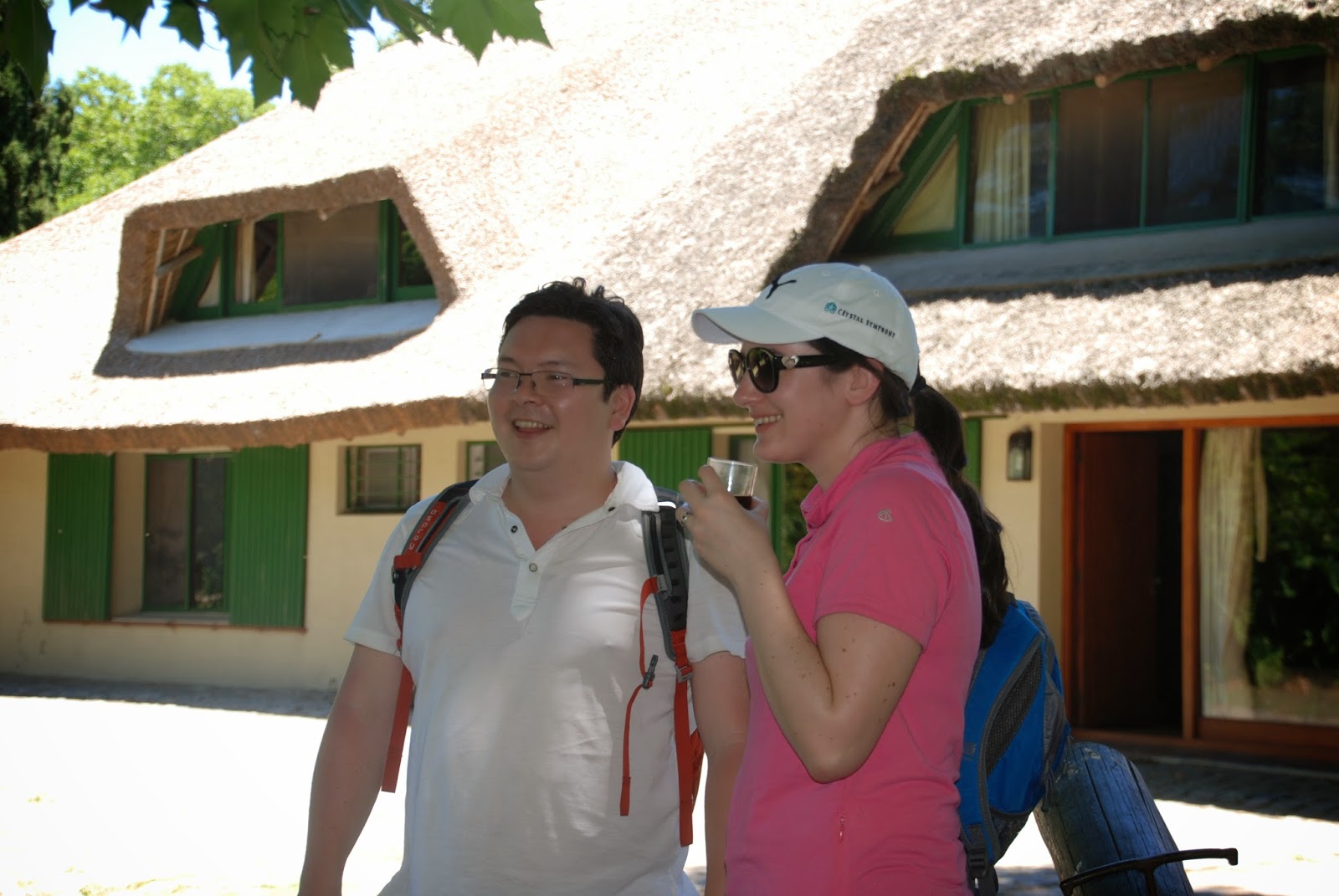
“We” was my son Ken Okumura, his wife Estelle, and me (along
with 900 of our closest friends J). (You'll see quite a few pictures of them in this blog entry.)Although as readers of my other blog entries since 2012 or who know of my
travels in the decades before that, will know I do not shy away from rough and
ready adventure travel ---and my next trip in June to Mongolia will be just
that. But there is something seductive about watching icebergs float by outside
the window while enjoying a fine five course dinner, or sitting in the open air
Jacuzzi champagne glass in hand as the whales spout and the penguins play, or
welcoming in the New Year in evening gown while passing through the dreaded
Drake Passage on the way to Cape Horn.
As those of you who have been following my travels for a
number of years will know, I love Antarctica and that was what attracted me to
this itinerary. My experience on this my third trip to Antarctica was very different
from the other two but as pleasurable as the other two and I am sure I will be
back there again within the next few years. In fact, my first trip to
Antarctica was on the Akademik Shokalskiy, the small scientific expedition ship
that was stuck in the ice in Antarctica over Christmas/New Year 2013/2014 and was the subject of worldwide
news bulletins as Chinese and Australian icebreakers sought to free her while
French, Russian and American ships stood by.
Many of the other ports of call were ones that I had visited
before (Buenos Aires, Ushuaia, Punta Arenas, Puerto Montt, Valparaiso,
Santiago--see my 2012 blog entries for notes on some of these) but there were
some new ones---Montevideo, Puerto Madryn and the Falklands. And I had never
actually circled Cape Horn (it is an island, which I didn’t know!) or sailed
through the Straits of Magellan and into the remote and inaccessible Chilean
Fjords.
And the contrast of temperature was as dramatic as the
contrast of scenery. Buenos Aires at the beginning of the trip was nearly 40
degrees centigrade and Santiago at the end was well into the 30s. And while it
was summer in Antarctica and we had for the most part beautiful sunny weather,
the temperature hovered around 0 degrees. And Ushuaia and the Chilean Fjords
were swept by strong winds, rain and snow. We were well kitted out for all the
different weathers we encountered, but I was amazed to see that many of our
fellow passengers did not seem to have read the itinerary or done any
preparation and spent days shivering in shorts and flip flops as we sailed among the icebergs. The boutiques on
board did a roaring trade in down jackets and binoculars for those who had come
unprepared.
People often believe that those of us who like to travel a
lot are either adventure travellers or luxury travellers, but not both. I think
that is a false distinction. I am certainly both. I like going off the beaten
track and am prepared to rough it if that is what is required. But I also very
much enjoy luxury cruises and top-end hotels and restaurants. They are
completely different experiences so you can return to a destination where you trekked
as a backpacker, and enjoy it all over again in a first class way.
That is what
I really like about travelling. You can go to the same place at different
stages in your life and experience it completely differently: you will have
moved on, got older, poorer or wealthier, be in the good health of youth or
with the aches and pains of maturity. And the place you visit will have moved
on—sometimes forwards and sometimes backwards.
For example I travelled through Egypt,
Sudan and Ethiopia when I was younger, a trip that would be much more dangerous
and difficult now than it was then. On the other hand when I was younger, places
like China and Vietnam were completely off limits. Now they are mainstream
tourist destinations with all modern conveniences available.
To travel across
the Soviet Union on the Trans-Siberian Railway as I did in the early 1970s when
it used steam engines and the handful of foreigners were transferred through
secret military areas in a special train carriage with blacked out windows, was
quite different from what I expect I will encounter when I travel on the
Trans-Mongolian and the Trans-Siberian Railways on my Mongolia trip this coming
summer.
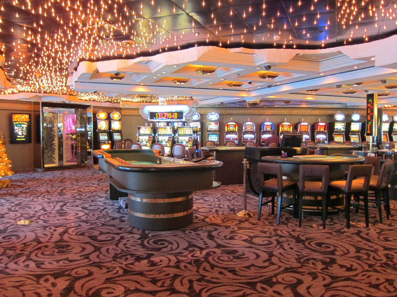
Before I move onto the more serious entries here are a few pictures of our life on board the Crystal Symphony over Christmas.
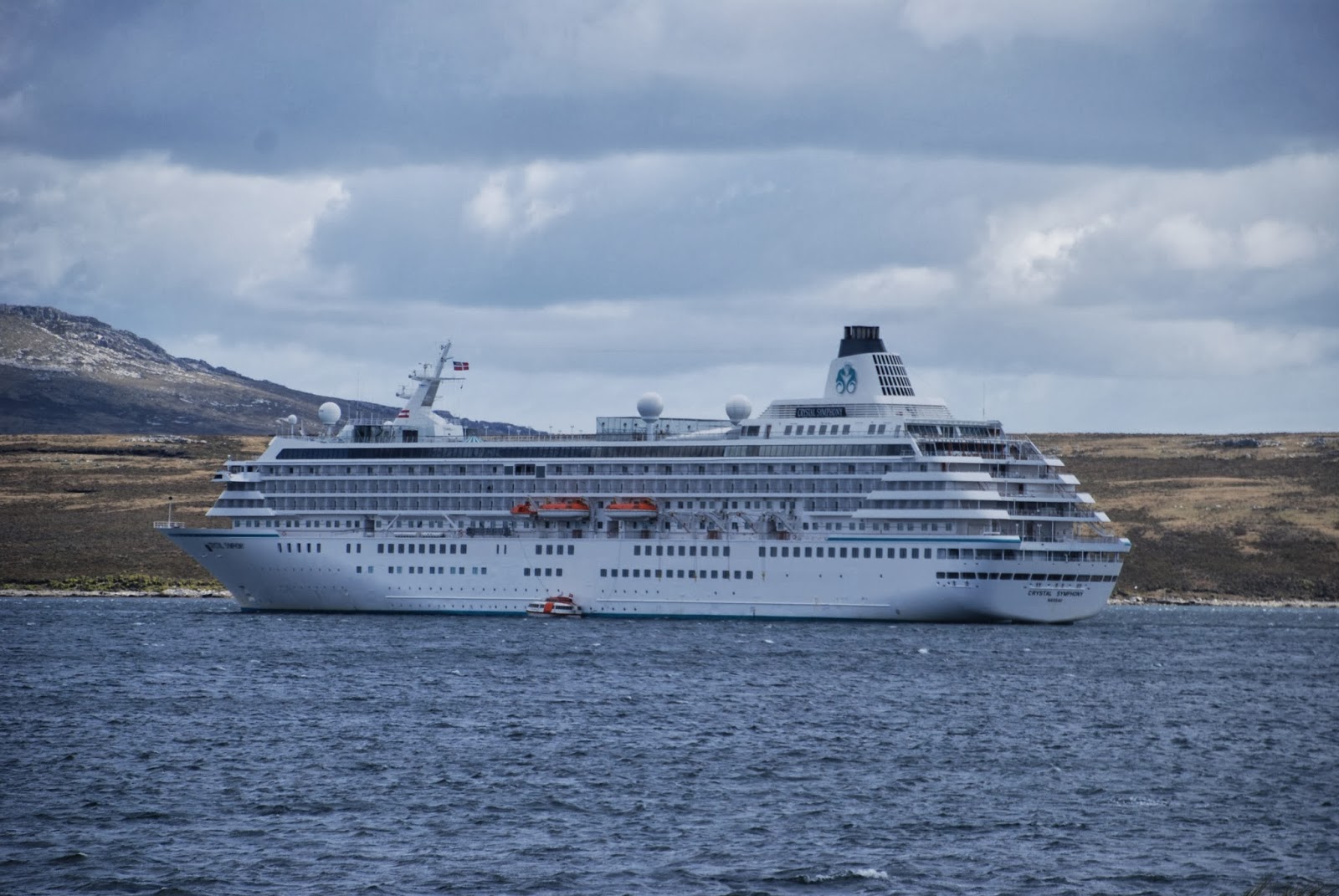 |
| Our ship, the Crystal Symphony |
Buenos Aires, Argentina
We only had one day and night in Buenos Aires, after the
long flight from the UK. It was blistering hot and the streets in the central
parts and around the Casa Rosada presidential palace were barricaded for
demonstrations so getting around was difficult. We later found out that the
demonstrations were to mark the anniversary of the day in 2001 when Argentina
defaulted on its international debts and its economy crashed. It probably will
do so again quite soon I suspect. It has already devalued its currency and inflation
is running at about 28%. Not a happy economic ship.
Since I had stayed in Buenos Aires for a month back in 2012
(see the archive of this blog for my observations and photographs) I was able
to take us on a lightning tour of some of the more accessible sights. Our hotel
was the avant garde Philippe Stark-designed La Faena in Puerto Madero (the
Canary Wharf of Buenos Aires).
We took a local bus over to the pleasant
well-to-do residential area of Recoleta (where I had an apartment in 2012) to
give us a flavour of local life, to see the famous Recoleta Cemetery and the
upmarket shops. Then a quick walk along part of the gigantic Avenida 9 de Julio
which cuts a 16 lane gash through the centre of Buenos Aires (it takes you
about 15 minutes to cross at all the traffic lights. Only those with a death
wish would jaywalk). It was started in a nineteenth century in a fit of hubris
to demonstrate that Buenos Aires was the Paris of South America.
And indeed the
city does have a very European look and feel and still has something of the air
of the world city everyone expected it to become in the twentieth century but
which never happened as Argentina sunk lower and lower down the world league
tables of prosperity.
We had lunch at the mid-eighteen hundreds’ Cafe Tortoni on
Avenida de Mayo, which was the centre of political and social life in the
nineteenth and early twentieth century. It is a bit of a tourist trap but quite
atmospheric. Then we walked past the Casa Rosada and the central Plaza de Mayo
where the mothers of the “disappeared” (Madres de la Plaza de Mayo) from the
1970s and 80s military junta still march every Thursday and back to our hotel.
Dinner at the touristy but excellent waterfront Cabana Las Lilas and then a
superb tango show at our hotel’s cabaret club. Whew!
Next day before we boarded
our cruise ship we spent a few hours in the lovely hotel pool. Our champagne
sail-away from the Buenos Aires port in the afternoon was a fitting start to our
cruise!
 |
| Lynn and Ken beside one of the "diques" (canals) in Puerto Madero Buenos Aires |
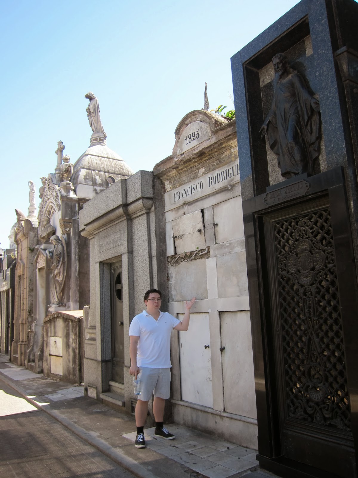 |
| Ken in front of one of the elaborate tombs in the famous Recoleta Cemetery in Buenos Aires |
 |
| Some of the feral cats that make the Recoleta Cemetery their home |
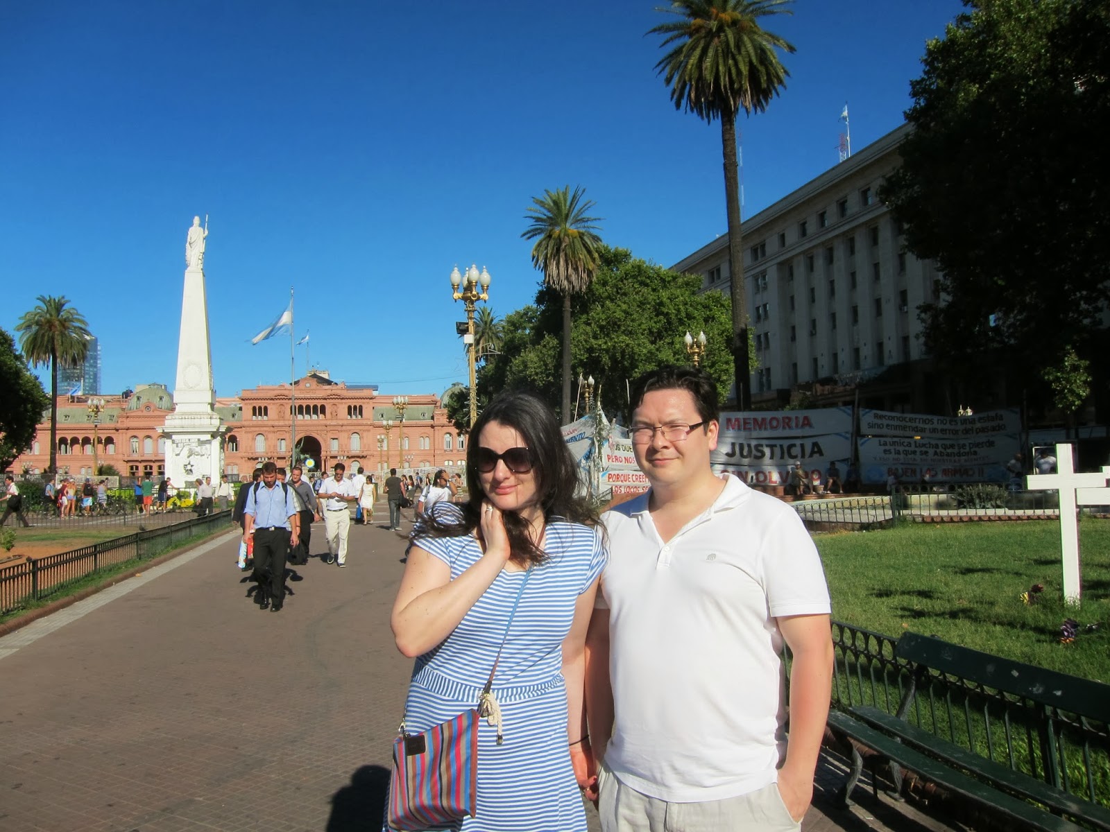 |
Ken and Estelle in the Plaza de Mayo with the the presidential palace"Casa Rosada" (Pink House)
in the background |
 |
| Ken and Estelle in the theatrical interior of La Faena Hotel in Puerto Madero Buenos Aires |
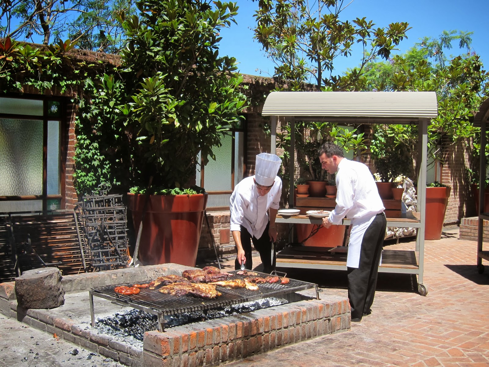 |
| The hotel "asado" (Argentinian barbeque) |
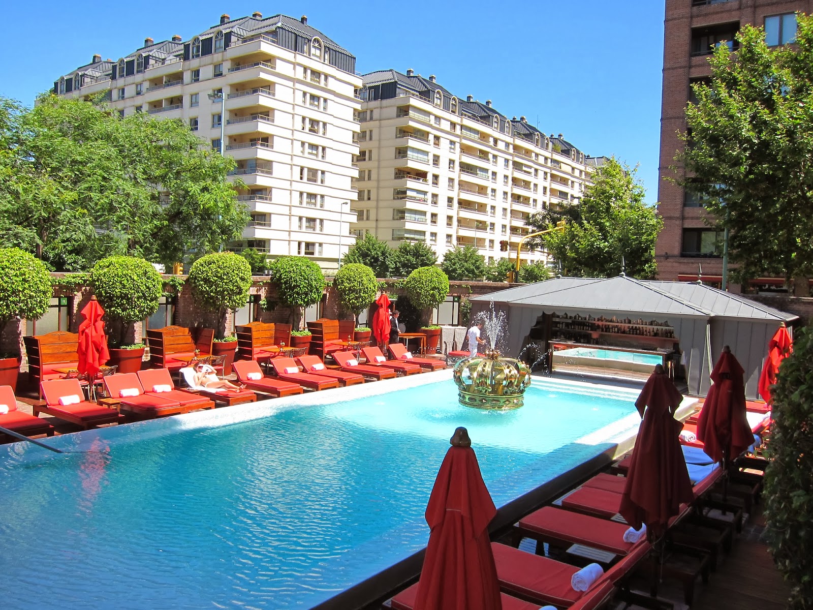 |
| The lovely pool in La Faena Hotel, Puerto Madero Buenos Aires |
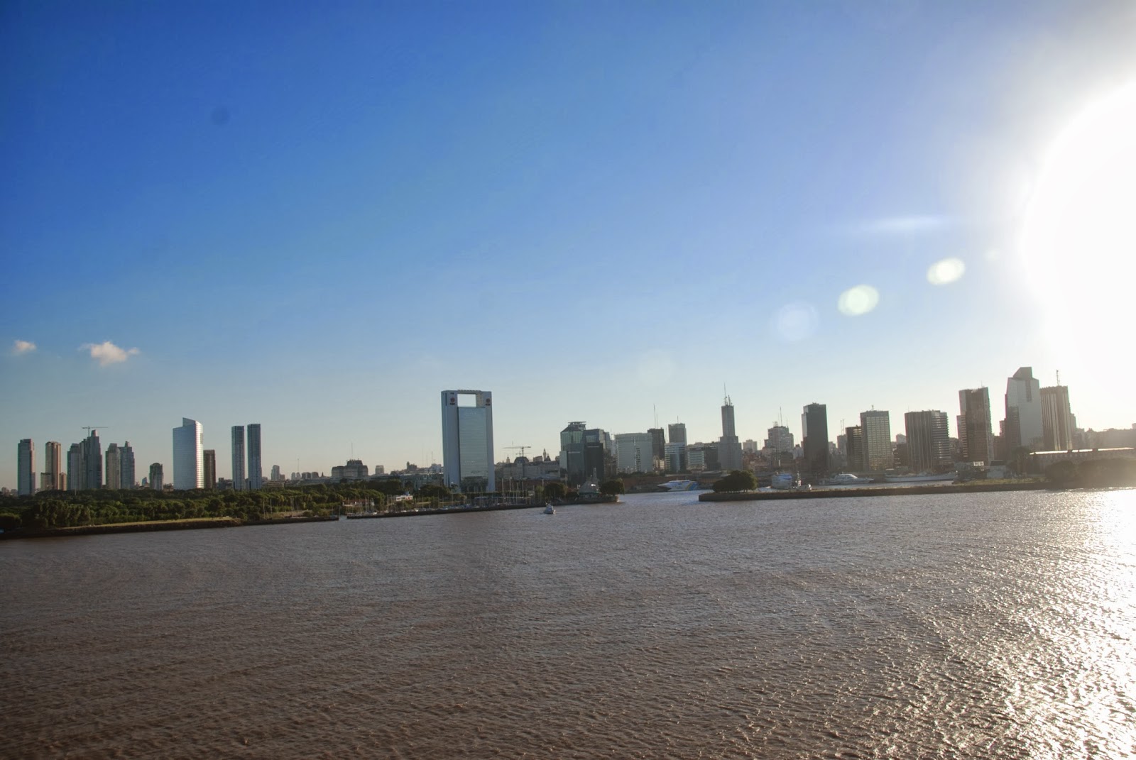 |
| Buenos Aires recedes as the ship sails away. Note the brown colour of the river. This is silt brought down by the Rio de la Plata from the interior of Argentina. |
Montevideo, Uruguay
Our first port of call was Montevideo in Uruguay, which is
only a few hours’ sail across the Rio de la Plata from Buenos Aires. Uruguay is
the second smallest country in South America (after Suriname) with a population
of only 3.5 million, 1.8 million of whom live in the capital city Montevideo.
Uruguay is flat and consists of rich estuary land between the Rio de la Plata
on the south and Argentina, Brazil and Paraguay on the west and north and with
a spectacular Atlantic coast on the east. It seems to be very stable and
wealthy, traditionally depending on its export-led agriculture (cattle) as well
as in recent years a thriving resort scene on the Atlantic coast attracting the
international jet-setting tourists and celebrities.
Uruguay was rather fortunate in hind sight because it
escaped the ravages of the Spanish conquistadors. Once they realised that there
was no gold or silver in Uruguay, the conquistadors lost interest until the Portuguese from
Brazil cast their eyes on expanding south to the Rio de La Plata and to the
rich lands of Argentina just across the river and the Spanish had to act to preserve their interests. The old colonial city of Colonia
(founded in 1680 directly across the river from Buenos Aires and an hour or
so’s drive upstream,from Montevideo) was tossed back and forth between the
Spanish and the Portuguese for decades until the Spanish founded Montevideo in
the 1724 and Colonia was left to moulder peacefully until its historic tourist
potential was recognised in the late twentieth century (see my blog from 2012).
Montevideo looks to be a pleasant Spanish colonial city with
some interesting architecture but it was Sunday and we were on our way to an
estancia (cattle ranch) to spend the day so we really just passed through on
the bus with a tour guide saying “on your left is... on your right is...” . The
estancia was great fun with a traditional asado (barbeque)and horse riding, but
I couldn’t say that I now know Uruguay intimately. That is a problem with a
cruise where you stop in ports for 8 to 12 hours. Unless you are very
self-disciplined in doing your advance research and keeping alert, you can
easily fall into a “If it’s Tuesday, this must be Belgium” frame of mind.
Puerto Madryn and the Peninsula Valdes
Now this was a disappointment. I’d toyed with taking a trip
down here when I was travelling in Argentina back in 2012 but now I am glad I
didn’t. To be fair, it is not a place which lends itself to a one-day flying
visit on a cruise ship. It is on the north-east coast of Patagonia and virtually all of Patagonia once
you are out of sight of the magnificent Andes along the west coast, is vast, mostly flat, featureless, treeless, scantly
populated, covered in brownish-grey scrub and apparently (it isn’t) lifeless.
This is not surprising since it was covered with the sea until quite recently
(in geological terms that is) and the ground is still saline and unsuited for
agriculture, just sheep grazing. Such a terrain can be fascinating (see Bruce
Chatwin’s “In Patagonia”) but not when you are in a bus with tinted windows for
hours.
The Golfo Nuevo where Puerto Madryn in situated and the sea
coast of the adjacent Peninsula Valdes are apparently teeming with whales,
penguins, seals and sea lions and the skies with birdlife. Diving in the Golfo
Nuevo is supposed to be excellent. However, Puerto Madryn itself seems to be an
ugly depressing semi-industrial sprawl. Most of the coastline is very
inaccessible except by dirt road and the distances are vast.
As mentioned
above, getting there is not very interesting as one drives for hours (our
excursion was 12 hours!) across the monochrome flat scrubland before reaching
the coast of the Peninsula. Granted we did see a few herds of guanacos (wild
relatives of the llama) and once we were at the coast of the Peninsula we did
see a large colony of Magellanic penguins and elephant seals and sea lions
flopped out on the sand with their pups below the high cliffs where we stood
(no whales though).
But I guess I am
just spoiled with having seen seals and penguins in greater abundance and much
more accessible than these were. It just didn’t seem worth all the hype that
the Peninsula Valdes gets.
The Magellanic penguins were fun though, and this was the
first time I had seen them. They are temperate climate penguins and since they
tend to breed at latitudes where the sun can get hot in breeding season, they live and raise their young in
burrows in the ground and under shrubs. They are pretty fearless too---as are
most penguins it seems—and you can get very close to them without them taking
fright.
Penguins are an interesting bird. They are a very ancient
species and have been around since before the continents drifted apart. So, for
example, the Magellanic penguins of South America are closely related to the
Cape Penguins of South Africa. Look at the shape of South America and Africa
and you will see how the two continents used to fit together and Patagonia and
Southern Africa would have been joined together. Similarly the Royal penguin
and the Macaroni penguin and the Rockhopper penguin are all closely related. Although
they are now found on sub-Antarctic Islands and the edges of continents on
different sides of the world thousands of kilometres apart, before plate
tectonics caused the continents to break up and drift apart the ancestors of
these three species lived only 1500 km apart. How extraordinary as well that
penguins inhabit only the southern hemisphere! The warmth of the equatorial waters
are a more effective barrier to migration of penguins than any land barrier
could be.
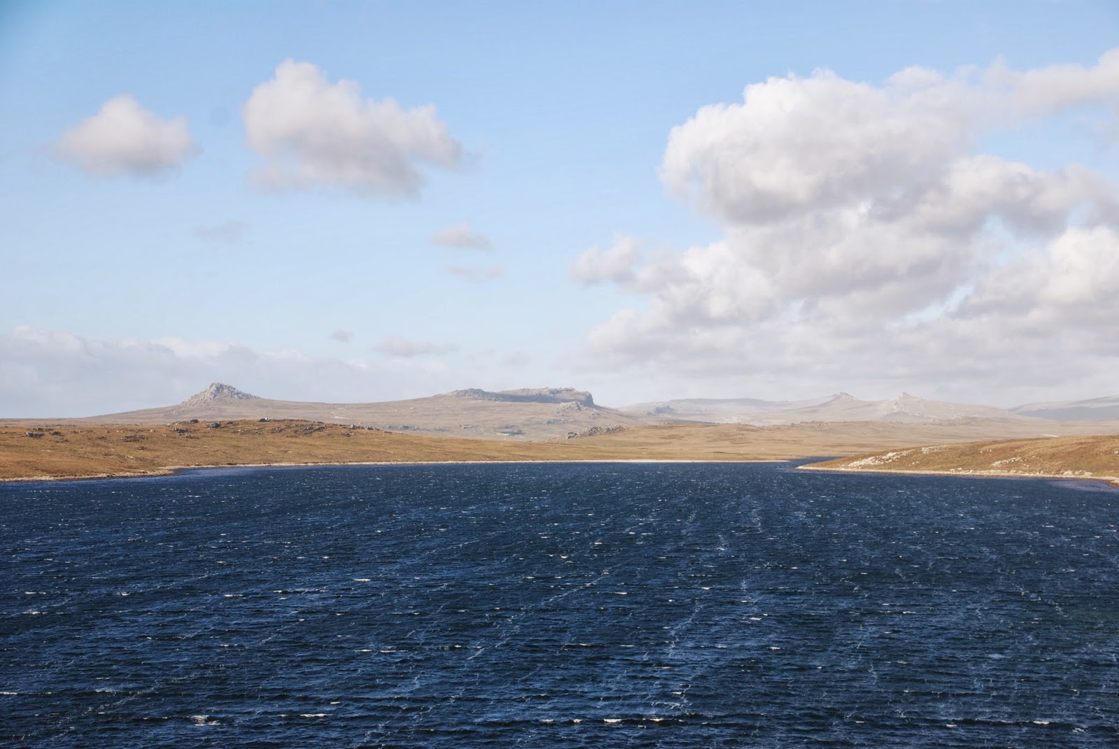
Falkland Islands
This was a real highlight for us. We were absolutely
charmed, particularly by the people. The population is about 3000, of which
about 2000 live in Port Stanley. The remainder live in “Camp” which is the name
given to everywhere else in the Falklands outside of Stanley. There are 700
islands but only the main two, East and West Falklands, are populated. It is
fairly hilly but none are higher than 700 metres. The climate is cool temperate—never
higher than about 20 degrees centigrade and never falling more than a degree or
two below freezing. There is little precipitation but lots of wind.
A remarkably large number of the Falkland Islanders are
descendants of the first British settlers in the 1860s, although there has been
a fair bit of later immigration –British soldiers from the Falkland’s war in
1982 when Argentina invaded, or who have been stationed there since and have stayed
on, a few Chileans, those looking for a new start in a simpler non-urban
environment, and more recently those attracted by the possibilities of an
off-shore oil boom. In addition to the permanent population there are about 2000
British military stationed there to forestall any further aggression by the
Argentina which is only 300 miles away.
From what we could see there is a good demographic age
profile with plenty of children and young people so it seems that the
Falklanders are thriving. It is clear that these people are British through and
through despite being so many thousands of miles away from Britain (8064 to be exact) and wish to
remain so –in their recent referendum over 99% voted to remain British. There
are red pillar boxes and red telephone boxes—not as twee tourist attractions
but because they are in daily use. Local people can fly back to Britain cheaply
on British military planes which travel twice weekly. Or there are regular
flights to Santiago in Chile. Wiley Chile, which has always been a rival of
Argentina for dominance of the southern half of South America, has stepped in
to befriend the Falklanders and so upstage Argentina’s belligerence.
The terrain is “bleak and rugged but not hostile” as one of
the ship’s lecturers aptly put it. Many people compare it to Scotland or Wales,
from where many of the early settlers came. There are no native trees but
plenty of interesting low bushes and plants with pretty little flowers and
berries, many indigenous to the Falklands. We saw, the “diddle dee” plant which
has a very seedy small red berry from which the local ladies make a tasty tart
jam, wild celery which really tastes exactly like celery, the vanilla daisy
which smells like chocolate, scurvy grass full of vitamin C.
There is plenty of
wildlife: crested duck, kelp goose, black-crowned night herons, cormorants,
upland geese as well as Magellanic, King and Gentoo penguins and sea lions. And
the rugged coastline shelters beautiful sandy coves which are a match for the
Caribbean (but colder of course!).
Shockingly, much of the coastal areas are still off limits because they
are still filled with landmines planted by the Argentinian invading forces
in1982.
But the best part about the Falklands is the people and the
sense of community they have established over the past 160 years. Completely
natural, welcoming, calm, contented, capable. Since there are only a few
thousand permanent residents, there are no professional tour guides. So activities
for the visitors on the 20 or so cruise ships that visit over the course of the
Falkland’s summer are run by local people who are either retired or who have other
“proper” jobs as well. So no false smiles and greedy hand rubbing.
We went on a
delightful nature hike around the bays and slopes near Stanley, led by a
retiree whose family has lived in the Falklands since 1860, and who was himself
imprisoned by the invading Argentinean soldiers in the 1982 war, knew every
shrub and bird we saw, and a fairly recently arrived (ten years) school
teacher. In the afternoon we went by school bus driven by a hearty local woman
(school’s on summer holiday) along one of the few paved roads driven, and then
by 4x4 driven by an ex-farmer (also one whose family had been in the Falklands
since the mid-1800s) across the muddy fields to a thriving penguin colony(King
and Gentoo) at Bluff Cove. This was followed by proper afternoon tea in china cups with
home-made cakes made and served by the local ladies.
Back in Stanley we visited
the Grove Tavern filled with British soldiers on their day off (it was Boxing
Day) watching the football, singing, flirting with the local girls and drinking
beer—just as you would see in Newcastle or Plymouth or London or any other pub
in the UK. I simply cannot imagine a
culture more alien to that of Argentina which still covets taking over “the
Malvinas” as they call the Falklands and continues to make war-like threats.
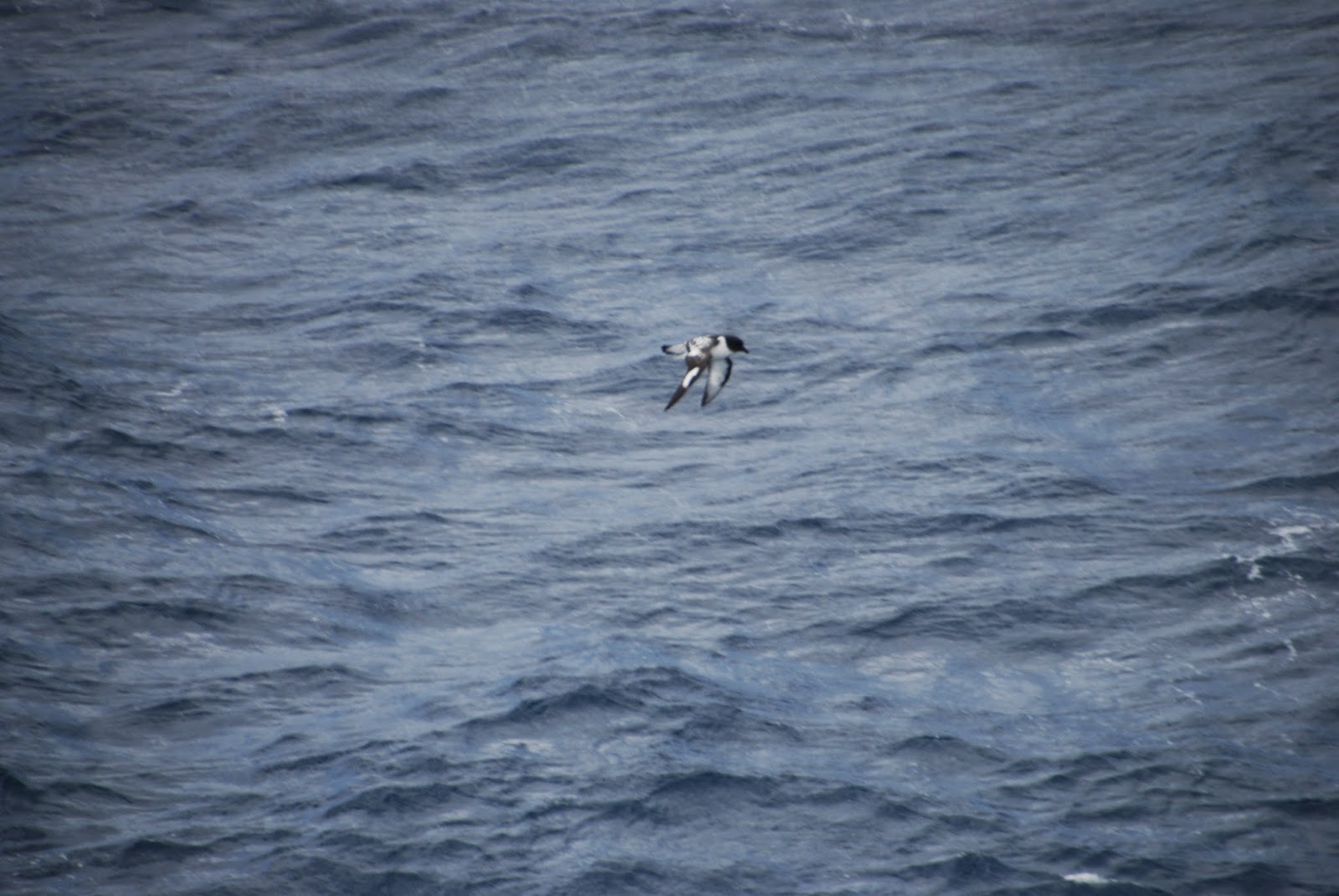
Cruising the Antarctic Peninsula
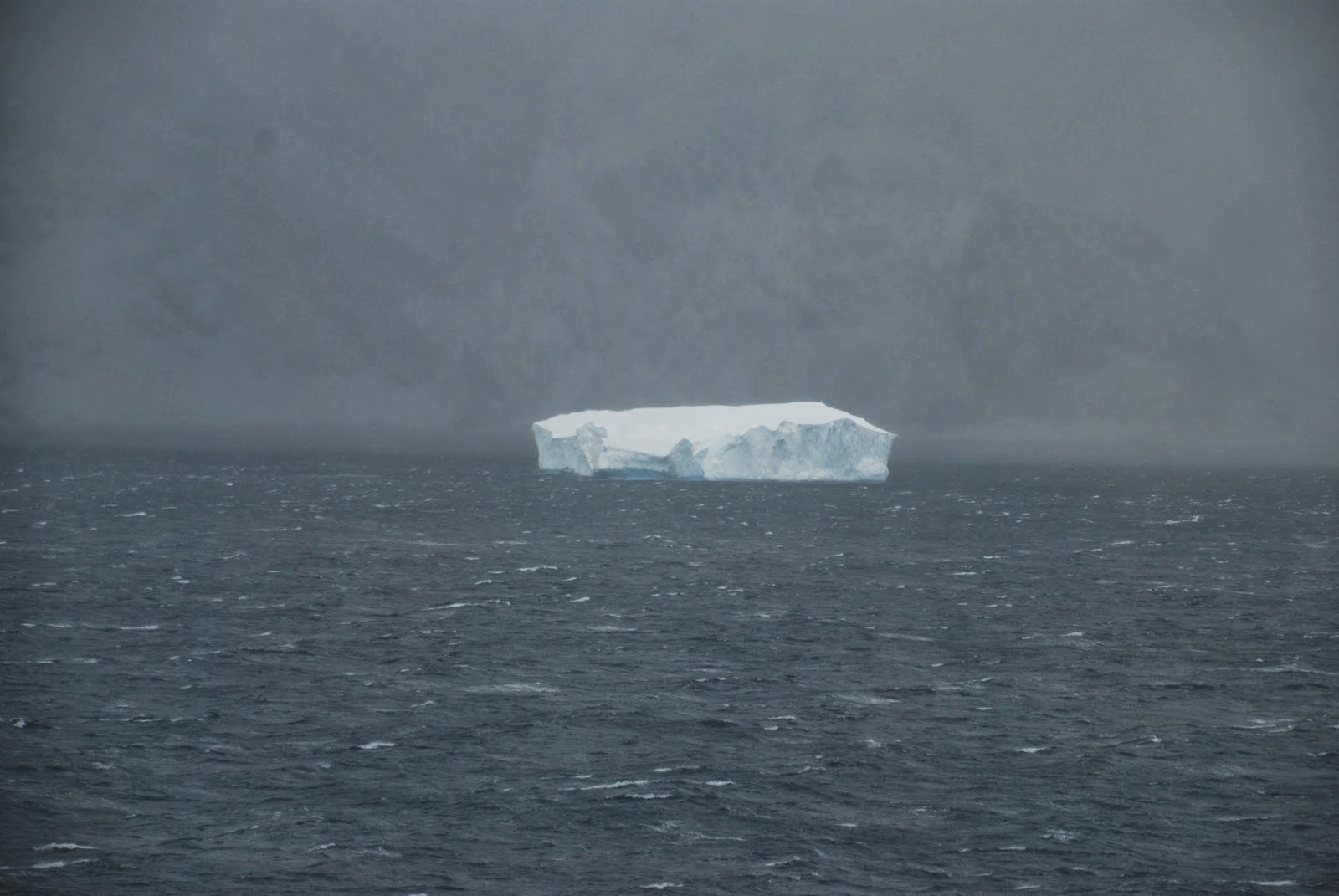
True to form, Antarctica laid on a mix of weather for us.
Our first day was bleak and incredibly windy---we couldn’t go too close to the
South Shetland Islands (Elephant Island and King George Island) on our
starboard side or our big ship despite its size would have been blown onto shore! But we saw icebergs.
Even though I have seen plenty of them on my Antarctic and Arctic trips nothing
quite beats that thrill of seeing one looming ghostly white out of the grey
mist. And penguins. And some whales spouting.
In the early evening the weather
was calmer and we were able to enter Admiralty Bay on King George Island and
enjoy seeing the icy slopes, craggy peaks, and the penguin colonies on
shore—hundreds of thousands of little figures covering the beaches and far up
the steep slopes. It is amazing what distances and heights these little
creatures can waddle upright on their little short legs and orange feet. And
they don’t do this only once---they make the long trip down to the seashore and
back up the cliffs several times a day to catch fish to feed their chicks. But
once they hit the water they are transformed into sleek bullets shooting
through the water at up to 20 miles per hour for hours at a time. Contrast that
with how fast you can swim—no more than about 3 miles per hour and only for a
short burst.
Admiralty Bay is the location of a cluster of scientific
research stations operated by the different nations who are members of the
Antarctic Treaty. (see my blog entries from January 2013 for further
information about the governance of Antarctica and that Treaty which preserves
Antarctica for scientific research---let’s hope it lasts forever). It is a
salutary and humbling experience to see these tiny human settlements of great
nations lost in the vastness of Antarctica. And how quickly Antarctica reclaims
the pitiful remnants of explorers’ and whalers’ visits! Memento mori.
The next two days were absolutely magnificent. We sailed
through “Iceberg Alley” (the Bransfield Strait), past Deception Island, through
the Gerlache Strait and the Neumayer Channel, around Anvers Island to the US
Palmer Station then back through the Neumayer Channel before heading across the
dreaded Drake Passage back to South America. The weather was glorious: brilliant
sunshine showing the pure colours of Antarctica—all shades of blue, mauve, pink,
silver, gold, blinding white. The sea was calm, the whales and penguins played
around the ship. The icebergs, the cliffs, the mountains, the glaciers, the
sea, the sky, looked almost benign in the sunshine, be-lying the ferocity,
power and danger which could appear at any moment with a swift Antarctic change
of weather. The only downside was that because of the size of our ship we were not able to land--only ships carrying 100 passengers or less are able to land passengers.
At Palmer Station (USA) we picked up a team of scientists
and station staff who gave us a very interesting talk and answered
questions—when asked how she had found her job at Palmer Station one of the
cooks said “Craigslist”! The Palmer Station people look forward to these cruise
ship visits and take the chance to stock up on good fresh food. It was
interesting to hear from them that the recent macho political power plays between
Republicans and Democrats in the US Congress which caused the shutdown of
government spending, has sabotaged the whole season’s scientific endeavours at
several of the US scientific stations in Antarctica. The staff had to be
recalled and all of their experiments mothballed and in some of the stations
the whole season’s work had to be abandoned.
Cape Horn and Ushuaia
The Drake Passage has been notorious since the very first
explorers in their tiny sailing ships sought a way to the riches and spices of
Asia by sailing around the tip of South America. The powerful winds and
currents which circle the Antarctic continent and protect it from the plastic
bags and other human debris of civilisation, all funnel through a narrow pinch-point
between the Antarctic Peninsula and the tip of South America. This causes
violent storms, winds and waves and even today in a large cruise ship with
modern stabilisers the waves and wind can throw you about and confine some
people to their (luxurious) cabins. It is impossible to imagine what it must
have been like in a little sailing ship about 75 feet long and about 100
tons—our cruise ship (which is not large by the standards of today’s floating
resort hotels carrying 5000 passengers) was 780 feet long and 51,000 tons! We had a relatively peaceful crossing of the Drake Passage
on New Year’s Eve and the ship’s lavish celebrations were not disturbed.
The
next morning we woke to find ourselves in brilliant sunshine circling Cape
Horn. I have never been there before and had no idea that it is not really a cape at the farthest tip of the South American
continent itself as I had imagined. Cape Horn is a cape at the tip of a fairly small
island which happens to be the furthest south of the numerous islands that make
up the bottom end of the South American continent. I was a little disappointed
to learn this!
But we were quickly able to see why “rounding Cape Horn” became
such a legendary experience, the ultimate test of a seaman’s courage. Although
we started our circumnavigation in lovely sunshine and with calm seas we soon
encountered rain squalls(with lovely rainbows) and increasingly strong winds
and blackening skies. By the time we returned to our starting point the weather
had deteriorated and we ploughed our way through cold and forbidding seas under
bleak black skies up the Beagle Channel to Ushuaia. In case you were in doubt
about the treachery of the Channel the hulks of abandoned ships in mid-channel
would soon put you right.
I've been to Ushuaia before (on my first trip to Antarctica)
and found it to be an attractively eccentric outpost with a ragged/ pioneering/hippy/
drop out/ new age feel to it, built on slopes leading down to the shore of the
Beagle Channel with the mountains of
Tierra del Fuego behind it. Tierra del Fuego (also a large island not mainland
South America as you might suppose)was occupied by several thousand indigenous
people of different tribes (Selknam and Yamana) before the missionaries arrived
to “civilise” them in the mid 1800s. In fact the name “Tierra del Fuego” was
given by Ferdinand Magellan because when he passed the island as he threaded
his way through the straits named after him in 1520 he saw the smoke from the
fires that the indigenous people had built on the shore.
The island of Tierra
del Fuego has been contested by Chile and Argentina for decades and currently
it has strange border running down the middle of the island. Since the mainland
above Tierra del Fuego is Chilean, Argentineans seeking to travel from the rest of Argenina by road to Ushuaia in Tierra del Fuego have to pass through Chile to get there.
In its early decades Ushuaia’s main reason for existence was
as a penal colony. But in the 1980s, to bolster their claims against Chile and
to stop further encroachment by them, Argentina made Ushuaia a free port, and
land and jobs in new businesses were promised to Argentineans who were prepared
to move there. The resulting influx of new settlers, eccentrics and chancers swelled
the population to its current 80,000, and although attempts to diversify the
economy have failed, it chugs along fairly well on the money brought by
tourists and adventurers going to Antarctica from its port and on its famous
King Crab fisheries.
The King Crab (centolla) is an enormous creature with
spider-like legs spanning a metre. Ushuaia was the only port where we stayed
overnight so we were able to go ashore to enjoy an excellent meal of crab and other
seafood at the family-owned and operated restaurant “Kaupe”. I highly recommend
it. We followed dinner with a visit to the Dublin Irish Pub, very popular but
not very Irish!
Punta Arenas
A short sail away from Ushuaia and you come to Punta Arenas (meaning
“sandy point”) on the Straits of Magellan and the most southerly Chilean city. And
it is a much more substantial (with a population of 120,000) and stylish place
than the hippy-dippy frontier city of Ushuaia. It was founded in 1848 and
thrived on the international shipping which passed through the Straits of
Magellan before the opening of the Panama Canal in 1914.This shipping wealth
brought waves of European immigrants (French, German, British, and a large contingent of
Croatians) who built a substantial European-style city with stone mansions and
a fine cemetery whose grand mausoleums and perfectly clipped cypress hedges
rivals the famous Recoleta Cemetery in Buenos Aires.
And even when the Panama Canal was opened and it lost its
monopoly on ships travelling to Asia and the west coast of the USA, the
enterprising city turned its attention inland to the four-legged wealth of the sheep
farms, and using the new technologies of refrigerated shipping, became a hub
for the export of frozen meat to the world.
And despite its diverse immigrant heritage it is resolutely
Spanish speaking. I find that an intriguing aspect of South America.
Despite the huge number of Italians, British, German, French, Irish, Greeks,
Balkan and Nordic peoples, Indians, and even Japanese who flocked to the
different countries of South America during its boom years in the last half of
the nineteenth and the first half of the twentieth century (not to mention the
indigenous peoples whose genetic descendents are still very visibly present in
the western and northern countries of South America, and not forgetting the
forced immigrants from Africa), they all ended up speaking Spanish (or
Portuguese in Brazil)! In the twenty-first century we see how Spanish is
spreading in the USA where 69 million speak Spanish as a first or second
language in the home. (*Note to self: work harder on your elementary Spanish or
you’ll soon have no one to talk to.)
Chilean Fjords
I suspect this name is a travel industry buzz phrase,
because as far as I can see the south western coast of Chilean Patagonia is not
made up of “fjords” as you would find them in Norway or Greenland or New
Zealand’s south island. It is difficult to describe because I don’t think there
are any other places in the world where this sort of terrain exists over such a
huge area. It is as if some giant’s fist has smashed down on the coastal lands
west of the Andes from the island of Chiloe (see my 2012 blog on Chiloe) in
mid-Chile all the way south to Cape Horn, and scattered the resulting fragments
into the sea as a jigsaw puzzle of islands.
It is quite literally impossible to drive all the way south
through Chile because there is no conjoined land west of the Andes to permit a
road to be built. General Pinochet did build a rough road (at enormous cost) as
far south as Villa O’Higgins (less than half way) but from what I have read you
would need a 4x4 as sturdy and reliable as a tank and an unlimited amount of
time to attempt a land journey on that road. There is a land route of sorts
through the central Altiplano far away to the east in Argentina but that is on
the east side of the vast peaks and glaciers of the Andes. Conversely on the Argentinean
side of the border as mentioned earlier there is no Argentinean land route to
Cape Horn or even to Ushuaia because Cape Horn and Tierra del Fuego are islands
and it is necessary to pass through Chile to get there. Ah, politics!
At the tip of South America a ship like ours with a good
local pilot can thread its way through the channels between the islands such as
the famous Beagle Channel and the Straits of Magellan and then through the
islands of the so-called Chilean Fjords but it is treacherous going.
Inaccessibility
means that the Chilean “fjords” are pretty much uninhabited with the exception
of the rare tiny fishing settlement clinging to the shore on one or two of the
thousands of islands (we didn’t actually see any at all signs of human
habitation at all). The islands, when you can see them through the fog and rain,
are craggy hills (not mountains) covered in green shrubbery.
We were never
close enough to the mainland (and I’m not sure you could safely get that close
since the channels are treacherous) to see the western side of wonderful Torres
Del Paine in the Andes or the glaciers like the Perito Moreno. These can be
accessed but with difficulty from Argentina but I don’t see how you could get
to see them from the so-called Chilean Fjords regardless of what the tourist
hype might suggest. Frankly unless there were bright sunshine (very rare I
suspect) and you were in a small and manoeuvrable boat I am not sure that there
is much to bring you back to the Chilean Fjords for a second visit.
However as you get further north up the coast things start
to improve. As the islands begin to coagulate into mainland again you begin to
see the wonderful snow covered cones of the volcanoes of this part of the
Andes. You also begin to see a few more ships and some habitation on the shore.
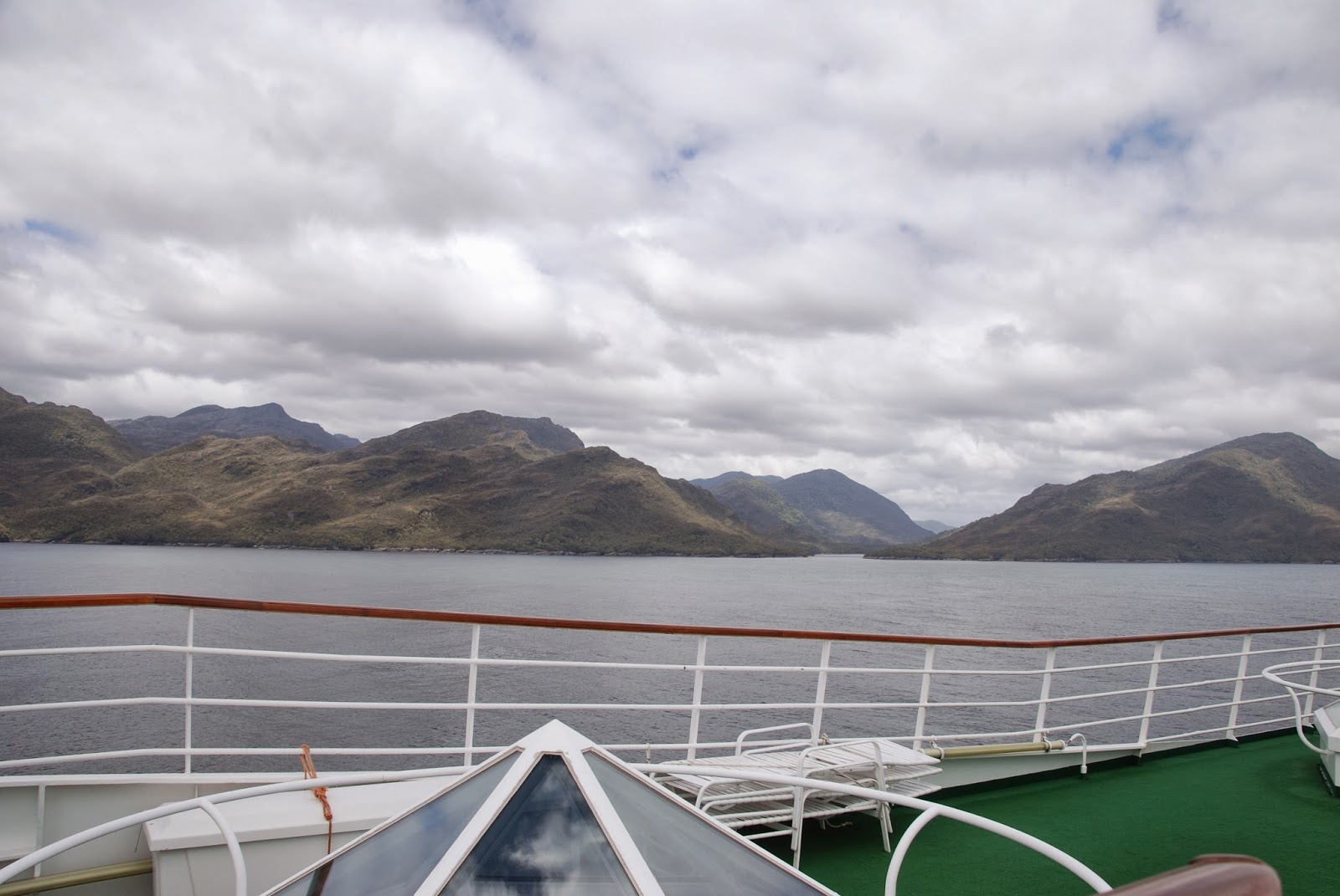 |
| The craggy hills of the thousands of islands that make up the route through the so-called Chilean Fjords |
 |
| The grey and uninhabited coastline and islands of the Chilean Fjords is not really conducive to a return visit |
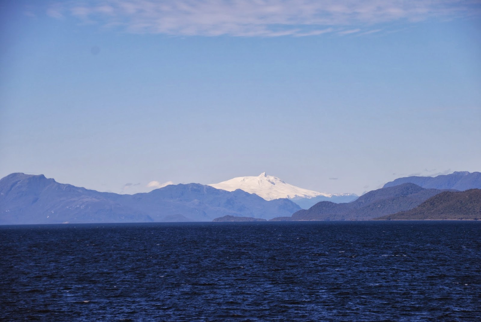 |
| As you get further north, though you begin to see the chain of magnificent volcanoes that dot this part of the coast |
 |
| another of the fine snow-covered volcanoes that are visible from the ship as it sails up the coast of Chilean Patagonia towards Puerto Montt |
Puerto Montt
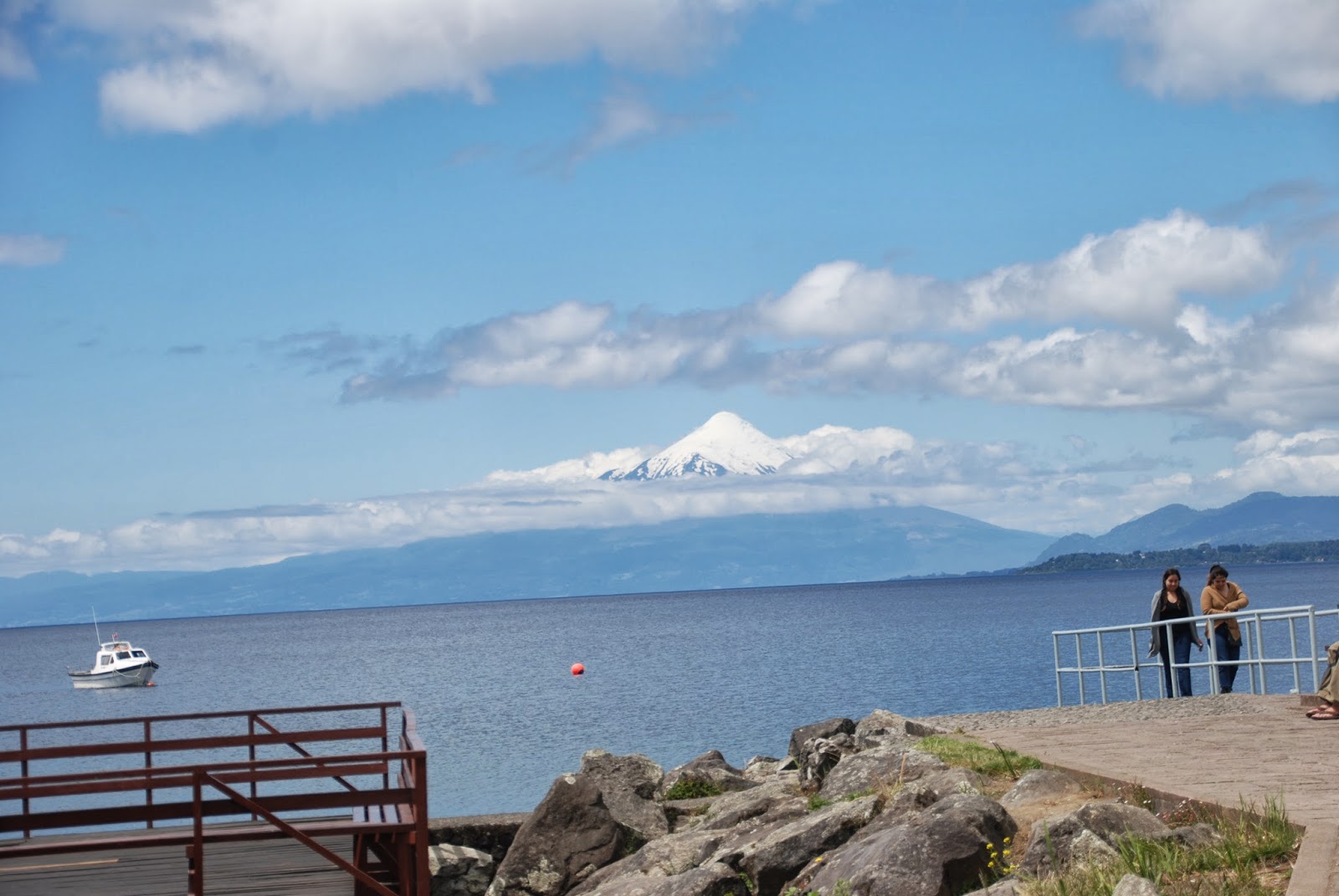
Puerto Montt is the main port on the west coast of Chile
south of Valparaiso and Santiago. It is in a fine protected gulf, has a busy
fishing and shipping industry , and its airport is the main one for accessing
the Chilean Lakes district. I’d like to say that it has a fine historical and
cultural centre but frankly the city is a sprawling dump with almost nothing to
recommend it for the tourist. This is not entirely its fault—it has suffered
earthquake damage over the years.
A quick exit to Lake Llanquihue and the attractive
small towns of Puerto Varas and Frutillar, the rich farmland around the lakes,
and the fabulous views of the perfect cone of Osorno volcano is certainly recommended.
I spent some time in this area when I travelled over the Andes from Bariloche
in 2012 (see blog entries) so I will not repeat my descriptions. This time we
went on a coach excursion from our cruise ship and although the weather wasn’t
great we had a very knowledgeable guide and we saw all that I had seen in 2012
and more besides, including the Saltos de Petrohue, a series of white-water
rapids and waterfalls cutting through the black lava on the western shore of
the picturesque Lago Todos Los Santos which is framed by volcanoes.
 |
| Poor old Puerto Montt does not have much to recommend it to the tourist |
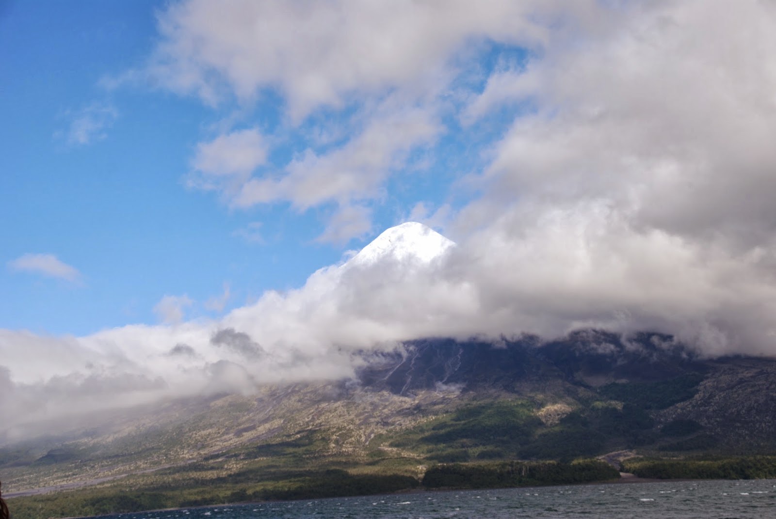 |
| A fleeting glimpse of Osorno's perfect volcano shape as seen from Lake Todos los Santos. For clearer pictures of Osorno see my blog from 2012 |
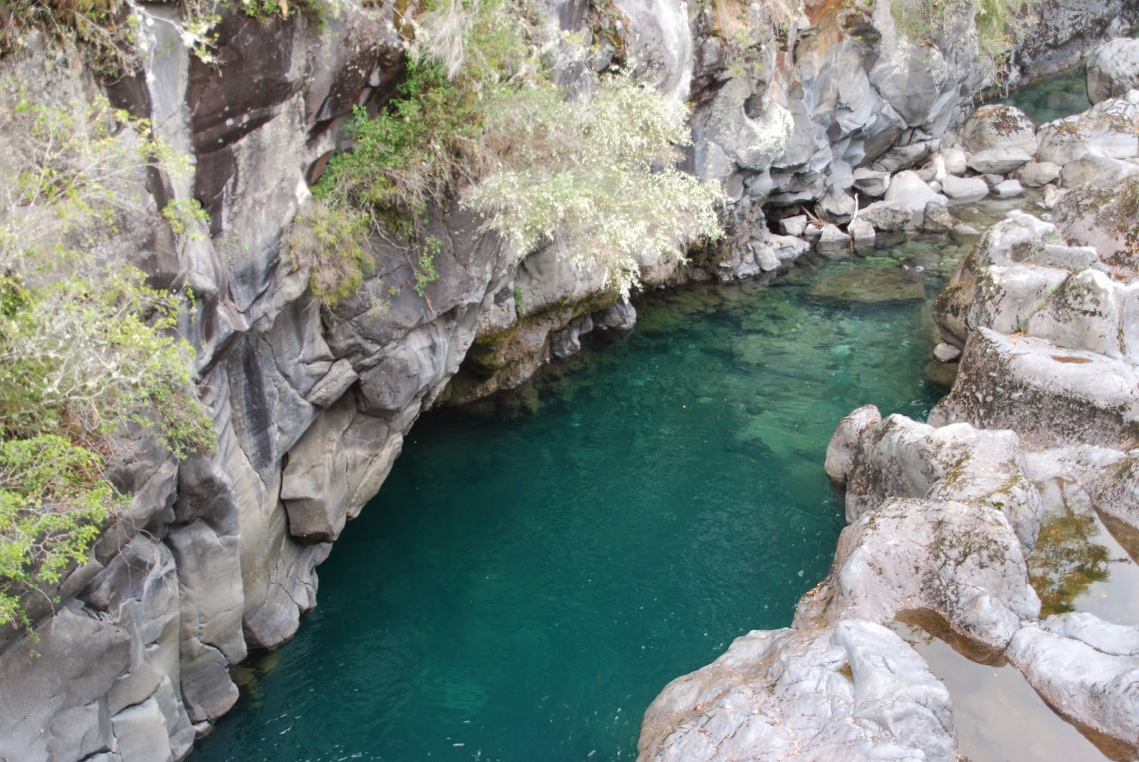 |
| The a quiet pool of clear emerald water beside the Saltos de Petrohue (waterfalls) where the water from Lake Todos los Santos carves its way through extremely hard lava rock on its descent to Lake Llanquihue. |
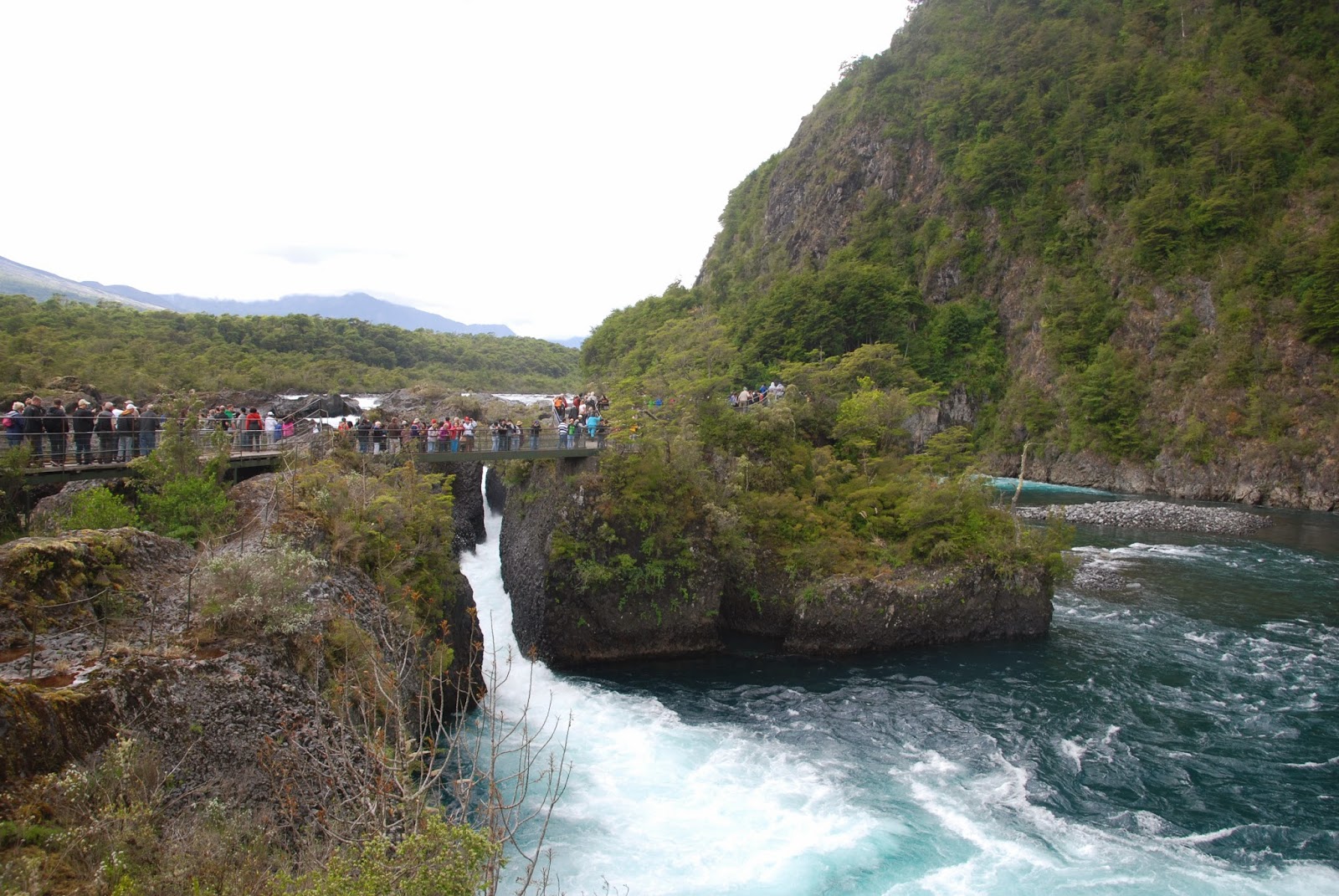 |
| The rapids of the Petrohue waterfalls. Because so much of Chile is dry from the Atacama desert to the dry plains of Patagonia, the exuberant flow of water at Petrohue make it a favourite destination for Chileans |
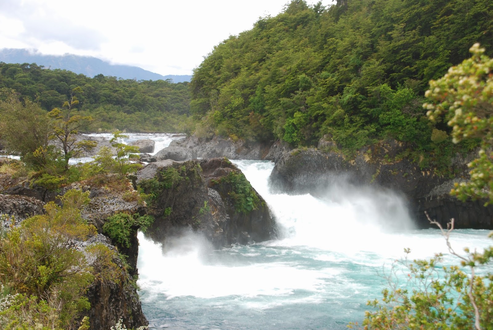 |
| The Saltos de Petrohue are not at all high but are very forceful and parts of the river are ideal for whitewater sports |
 |
| A glimpse of the Osorno volcano which is often clearly visible from Puerto Varas across Lake Llanquihue. For clearer pictures see my blog from 2012 when I was here before. |
Valparaiso and Vina Del Mar
This was our last port where we disembarked from our cruise ship. We spent the
day visiting Valparaiso, Vina Del Mar , a vineyard in the Casablanca Valley and
ended the day inland in Santiago. I have been to Valparaiso once before but without a
guide.
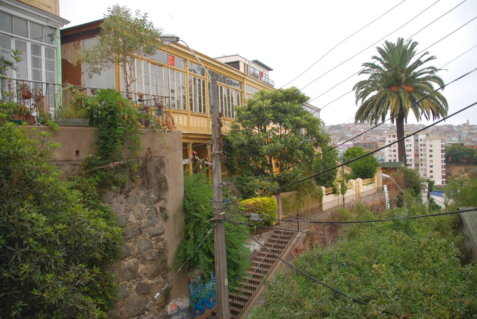
Because Valparaiso is scattered higgledy-piggledy over 45 hills forming
an amphitheatre falling down to a narrow coastal strip and bay, it is a town
where a guided walking tour is really valuable. Because most of the streets (really
only lanes or alleys many of them turning into flights of steps) have no street
signs and are very steep, very narrow and wind around the contours of the hill,
you can get lost within two or three minutes and as a result you will miss so
much. If you had a lot of time getting lost in the streets would be great fun
since around every bend is a new surprise and ultimately you could find your
way down to the harbour again since every alley and house has a view over the
bay. But with limited time it is good to have a guide. Although there are a few
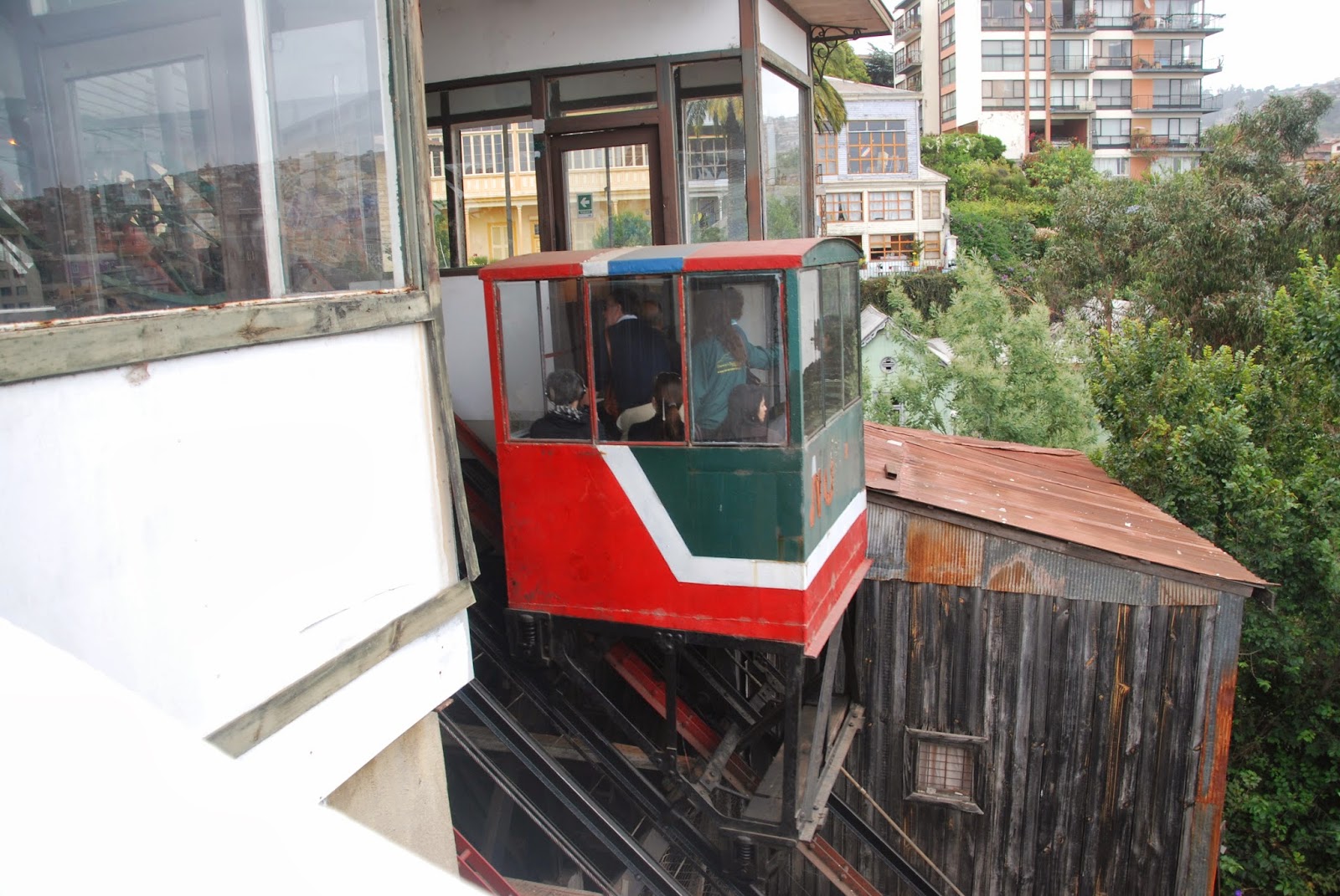
streets that you can drive up, most of hills are accessed by foot or an “ascensor”
(antiquated funicular elevator).
Valparaiso is an old city—1542—but it enjoyed its heyday in
the 1820s when it was the major port on the west coast of South America ,
resupplying all the ships making the voyage round Cape Horn and on to Asia or
to the west coast of North America which was booming in the mid-nineteenth
century California gold rush. It lost its maritime supremacy in the early
twentieth century when the Panama Canal opened, following soon after a
devastating earthquake struck in 1906. But it struggled through and has enjoyed
something of a renaissance becoming an important seat of government and
business but also home to a thriving artistic community.
It beautiful setting
and its quirky colourful houses on the hills with their tin siding (to reduce
the ravages of the salt sea winds) and quaint streets are a magnet for tourists
as well. The coastal strip where the business and government centre and the
port is are less interesting and here the decay and ravages of time and salt and a slow economy look merely seedy rather
than artistic and quirky like the houses, craft shops and galleries on 45
hills.
Vina del Mar is a resort town only a few kilometres up the
coast from Valparaiso but centuries away in atmosphere. It was founded much
more recently than Valparaiso(in 1878) and is slightly larger than its near
neighbour and predecessor Valparaiso (280,000 as against 255,000). Its long coastline
with its picturesque bays, beaches, cliffs, with sea lions and sea birds are
very attractive. Its downtown area is filled with apartment buildings, casinos
and shops. It likes to refer to itself as the “Garden City” and indeed it is
well endowed with greenery. We didn’t
really have enough time to see the place properly but I can see why it is such
a popular holiday spot for Chileans.
 |
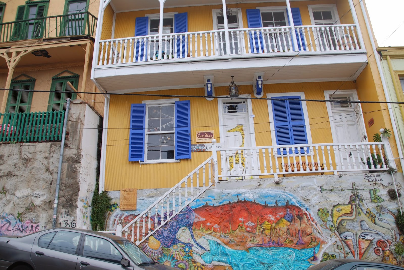
| One of the wide variety of colourful buildings clinging to the hills of Valparaiso |
 |
| Valparaiso--many different architectural styles |
 |
| One of the nineteenth century elevators which are still the main way to reach the hillside homes of Valparaiso |
 |
| All the Valparaiso hillside houses, elaborate or simple, make the most of the sea view with balconies, terraces and huge windows |
 |
| This one was squeezed in to make the most of a tiny piece of flat land on the Valparaiso hillside |
 |
| Valparaiso is a haven for artists and there are many colourful murals like this one on the hillside houses. |
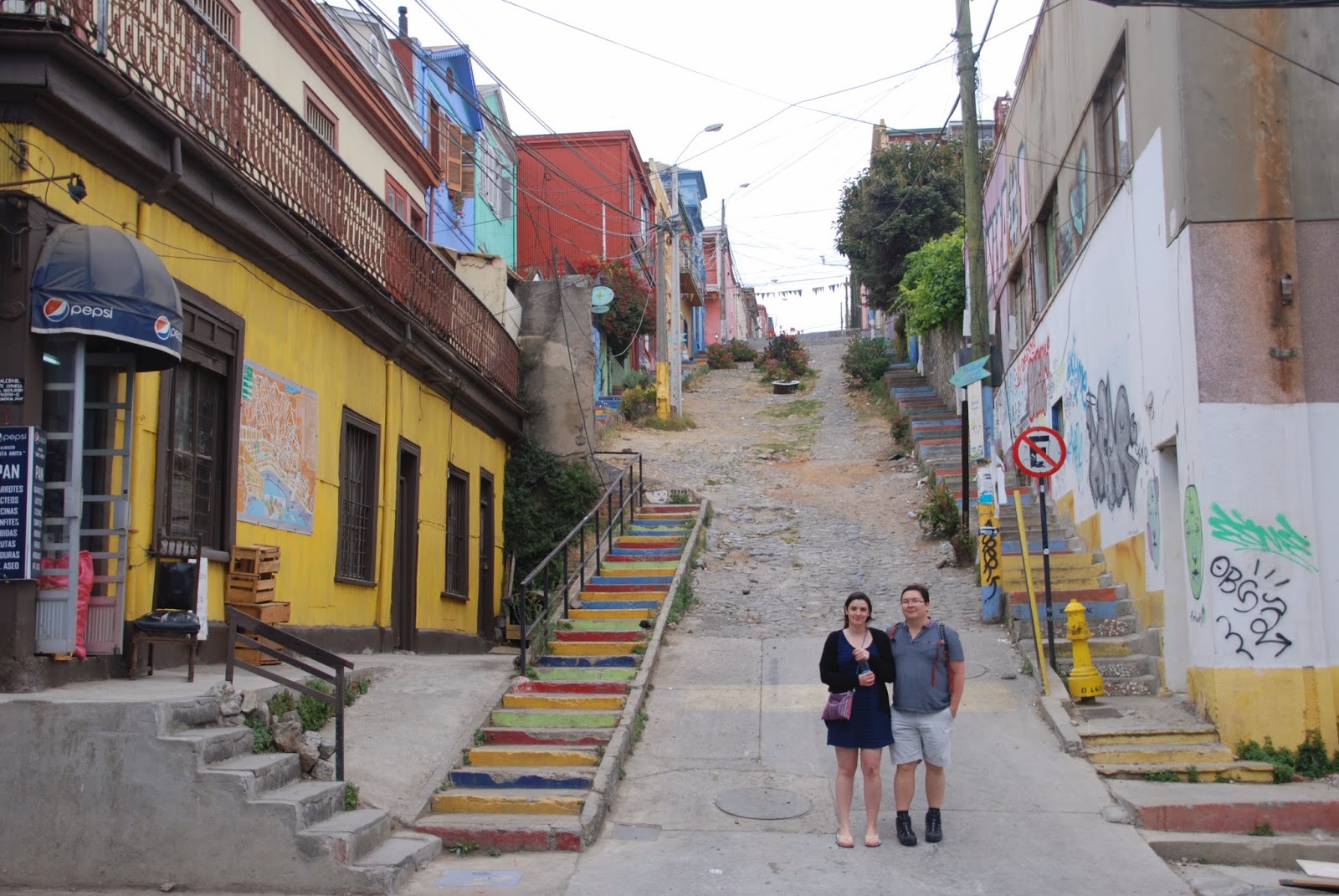 |
| Ken and Estelle on one of the steep rough roads (not suitable for cars) that ascend the hillsides of Valparaiso. Every surface including the steps are colourfully painted |
 |
| A charming terrace on a Valparaiso hillside |
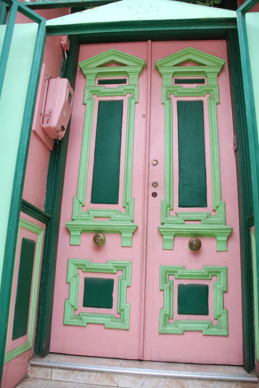 |
| a fine Valparaiso door |
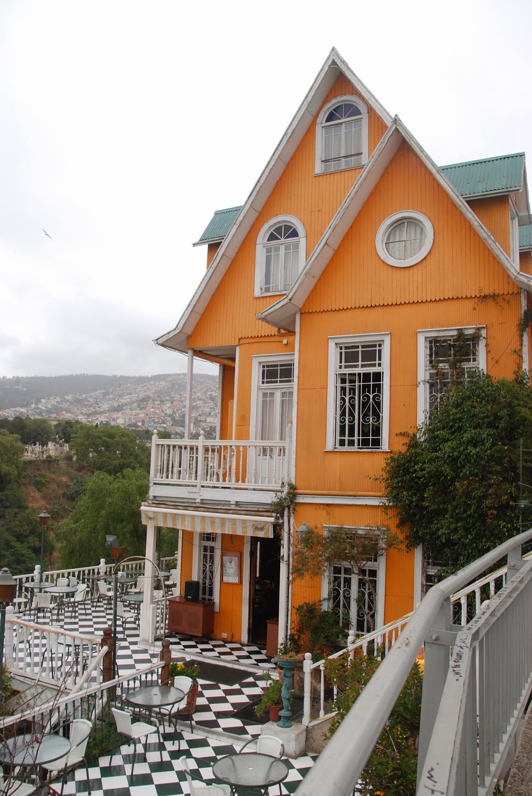 |
| Another fanciful Valparaiso boutique hotel |
 |
| The beautifully restored naval headquarters in Valparaiso |
 |
| A small sandy cove along the Vina del Mar coast where we had lunch |
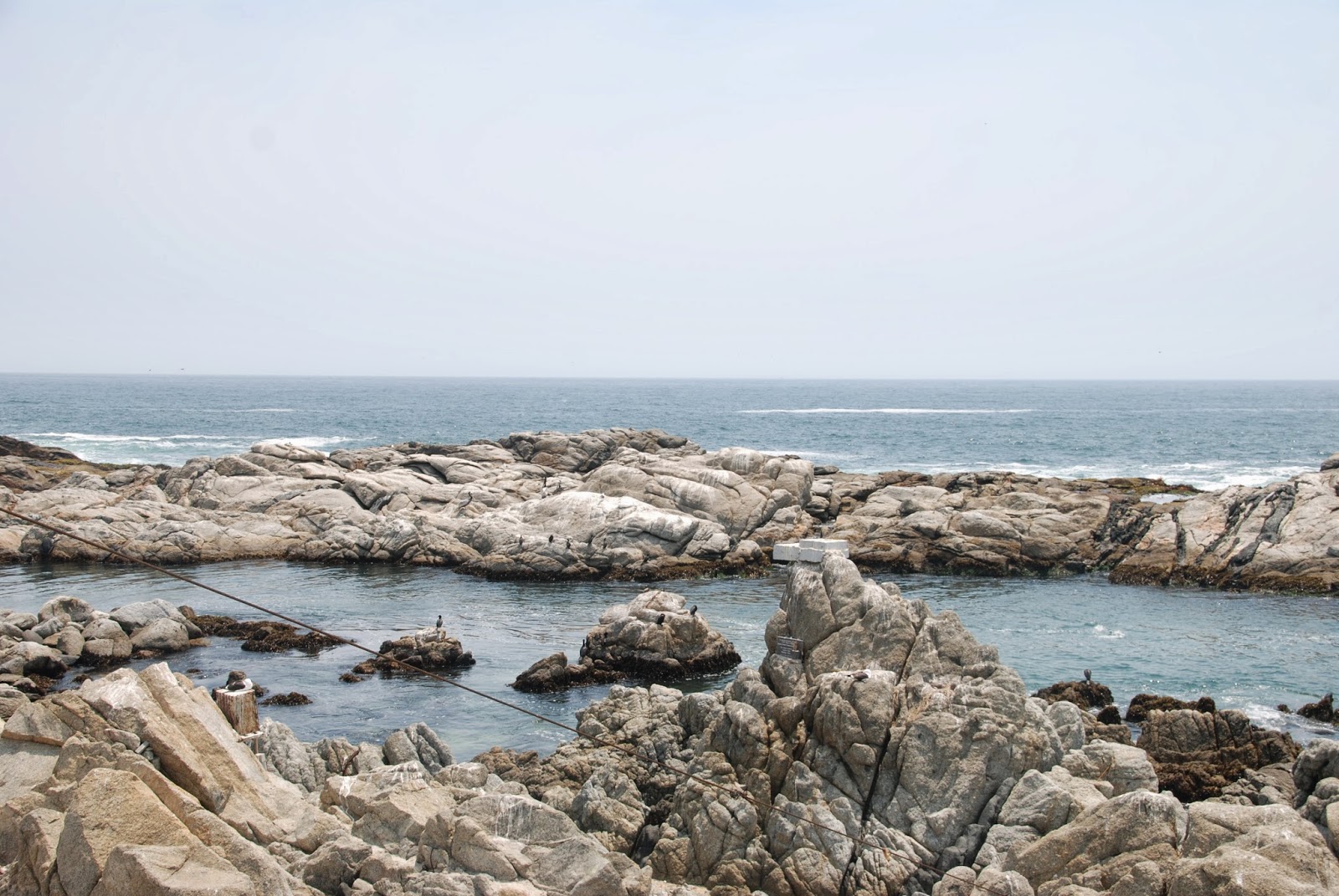 |
| Rock pools on the coast of Vina del Mar |
 |
| Note the mass of sea lions on the rocky outcrop close to the shore in Vina del Mar |
 |
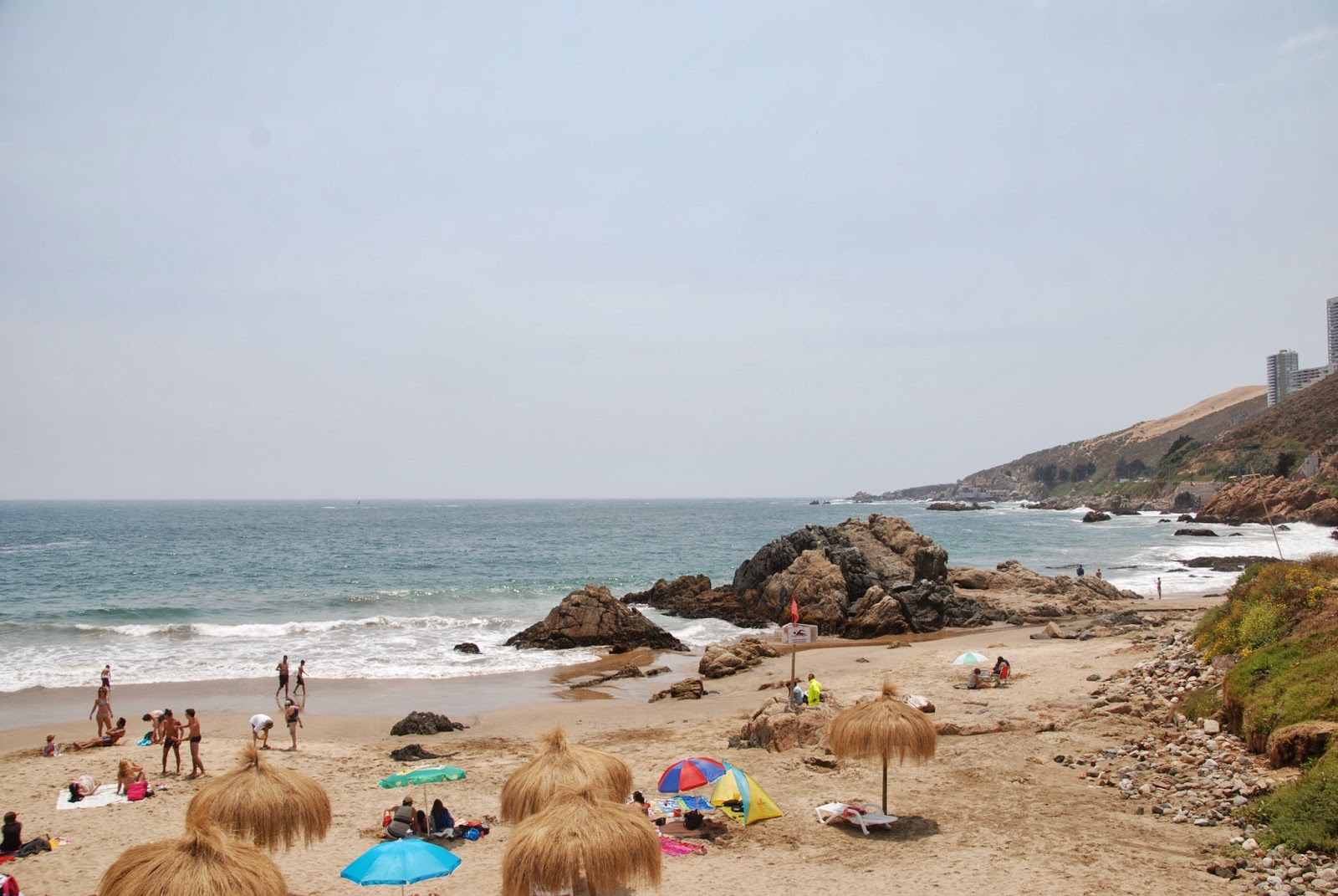
| There is a great variety of beaches in Vina del Mar, from wide sandy beaches to small rocky coves. |
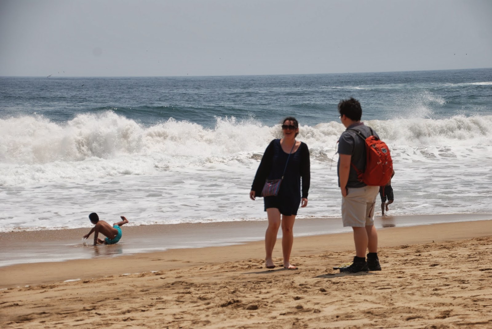 |
| Estelle tries out the Pacific waters on a beach in Vina del Mar |
From here we drove on to Santiago, stopping at one of the
vineyards which line the route through the Casablanca Valley. I guess I am
destined not to see the wonderful snow-capped Andes which apparently form the
backdrop to Santiago as you approach through the Casablanca Valley from the
coast.
The smog in Santiago is appalling (like Los Angeles it suffers atmospheric inversion that traps pollution
close to the ground). This time it was made worse by smoke from a dreadful
forest fire to northwest of Santiago.
I don’t know if the pollution is the
cause of it but the last time I was in Santiago and this time I came down with
quite a nasty respiratory infection and so I still haven’t seen what Santiago
has to offer. I spent most of the day and half we were in the city before our
flight back to London in bed. Fortunately we were in a lovely boutique hotel,
Lastarria, in the historical district which I highly recommend if you happen to
be in Santiago.
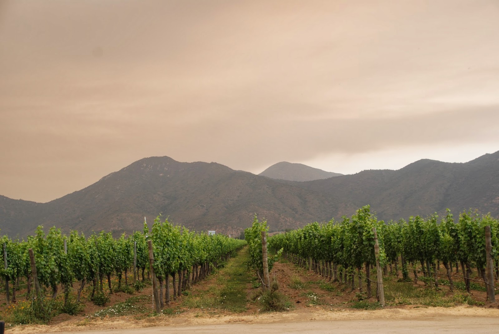 |
| Note the smog over the vineyard Emiliana. Although on this occasion the smog was intensified by a forest fire in the north, bad smog seems to be a constant hazard in Santiago just as it can be in Los Angeles. |
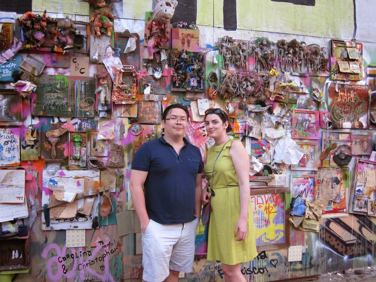 |
| Ken and Estelle on our last day in Santiago in front of an interesting wall collage in the trendy student/historic district of Lastarria |
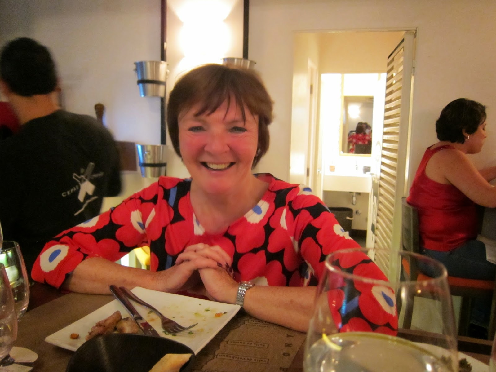 |
| Final meal at Bocanariz in Santiago's historical Lastarria district before returning to London |
And so we returned to London to the dreadful floods and
winds which have plagued the UK this winter. Fortunately we are not affected
here in London but the scenes on the television screen are apocalyptic, the
wettest winter in history and many fields and homes are still under water.
I expect my next blog entries will be in the summer when I undertake my adventure to Mongolia, so check back in about July to read all about it.