Mongolia- Part 2
Mongolia-the land
Mongolia is one of those beguiling places that you can hardly believe still exist in the twenty-first century---and I mean that as a compliment. For starters it is HUGE. It is the size of Western Europe but has less than three million people. Think of it:- the whole country has a population a third the size of London or New York City. Neighbouring China has 40 cities that each has more people than the whole of Mongolia.
Almost one half of the population lives in the main city, Ulan Bator (or Ulaan Bataar as it should be spelled to catch the nuances of the Mongolian language), so the remaining one million or so people have this huge country to themselves.
Scenically it has extraordinary variety, from the Gobi desert in the southern third of the country to the Siberian taiga underlain by permafrost in the north. The whole country was formed by the crash of tectonic plates 40 to 50 million years ago or so, when what we now know as India crashed into Asia and pushed up the Himalaya Mountains.
The resulting earth movements elevated the Gobi and central Mongolia, which had been a dinosaur-friendly sea and swamp, many hundreds of metres higher and threw up mountain ranges and unleashed tremendous volcanic action throughout the area.
Subsequent ice ages brought severe glaciation to parts of Mongolia particularly in the north, leaving behind sharply pointed conical mountain peaks, deep steep walled valleys, moraine of loose rocks and gravel and great level plains dotted with “rock castles” of ancient granite boulders like those at Khogno Khan which predate the geological upheavals of the past 40 or 50 million years and which have been sculpted and eroded into pillars and giant boulders by the subsequent glacial action. Rains over thousands of years have leached out minerals leaving mudstone towers of fantastic shapes and colours.
And so Mongolia has mountain ranges, wide valleys, volcanoes, flat steppes and deserts containing marine fossils, dinosaur eggs and skeletons as well as huge, as yet barely touched reserves of minerals, coal and probably oil and gas.
And in the north of the country the Siberian taiga (the sub-Arctic coniferous forests which stretch across Russia, Scandinavia and Canada) takes over and the slopes of the mountains area a mosaic of dark forests and sunny meadows. Where the prevailing winds from the north drop rain, there are islands of forest with tall graceful larch trees with straight trunks and soft needles and with very little undergrowth. On the sunny southern, eastern and western slopes lighter green steppe meadows are covered with astounding wild flowers. Pristine streams and rivers flow north through wide river valleys and steep sided canyons, eventually reaching the Arctic Ocean.
Because of the extreme climate and terrain you can find canyons in the “Three Beauties” mountains ( the most easterly extremity of the “crumple zone” earth movements which formed the Himalayas) in the northern part of the Gobi Desert that are still choked with ice in late June. Of the five days we spent driving in what is technically the Gobi Desert we had rain on four days! And there is very little sand (in the beach sense) in the Gobi (except in the inaccessible southwest). It is mostly dead-flat coarse dry gravelly ground with sparsely scattered clumps of tough rough grasses.
All the volcanoes are now extinct but as recently as 4,000 years ago volcanoes were spewing lava. For example at the beautiful White Lake in central Mongolia black teeth of lava jut up from the surface of the lake and you can still gaze into the crater and walk in the lava field at its base.
Mongolia has Lake Khovsgol, one of the world’s 17 "ancient lakes" (those that are over one million years old and were caused by faults in the earth's crust rather than glacial action which formed most of the world’s lakes about 10,000 years ago including Canada's Great Lakes, for example). Lake Khovsgol, about 2 to 5 million years old, is a sister to the massively deep and mysterious Lake Baikal a hundred kilometres further north in Russian Siberia. Unlike Lake Baikal however, it is so clear and pristine that there are very few nutrients in it to support fish life.
The following are photos of the scenery on our trip. Photos of people, animals, daily life etc are in subsequent posts. In these photos I hope to convey something of the huge variety of landscape in Mongolia. And there is variety within variety. For example in the middle of the Gobi desert is a range of mountains where the canyons are full of ice until mid-summer. And there is a "mini-Gobi of sand dunes in the heart of the country hundreds of kilometres north of the Gobi.
These photos are in strictly chronological order so you can see the changes we saw on a daily basis. Our route took us in a rough oval loop from Ulan Bator, south through the Middle Gobi, into the Southern Gobi and into the mountains called the Three Beauties which rise out of the desert and stretch through the centre of the Gobi. Then back north out of the mountains and into the Southern Gobi again, and then returning back across the mountains into the Gobi to the Singing Sands sand dunes.
From there we drove north through dramatic volcanic landscapes and into the central steppe. Then into trees and rivers and lakes again. Our furthest north was Lake Kovsgol surrounded by the taiga forests growing on permafrost.Finally we curved back south through the agricultural and industrial heartland and back to Ulan Bator. We only covered a fraction of the country, so there is more to see on another trip.
 |
| Leaving Ulan Bator. Note the traffic and the building cranes |
 |
| The outskirtts of UB. Note the compounds and the variety of accommodation within them. See later parts of this blog for why these compounds are surrounded by fencing. |
 |
| Soon out in the pasture land, the wide open spaces and the herds of animals |
 |
| Moving into the Middle Gobi . The landscape becomes more barren, but still remarkably green because of the ample rain this season |
 |
| Gazelles streaking across the rolling hills |
 |
| Our first luncheon picnic amidst the course grass and flowers of the Middle Gobi |
 |
| Horses at a natural watering hole in the Middle Gobi |
 |
| The strange granite "pancakes" of the Baga Gazriin Chuluu formation which rises from the flat bare plains |
 |
| The same |
 |
| The same |
 |
| Believe it or not this is also Baga Gazriin Chuluu! Amidst the strange granite formations is a spring which nurtures these birch trees, the only trees for many hundred kilometers. |
 |
| Our first sight of camels. As you can see we are moving further into the Gobi, but this is not "beach" sand. This is rough gravelly sand. |
 |
| Tsagaan Suvraga. Colourful limestone formations rising out of the dead flat desert. You can see that there are layers of marine fossils, tell-tale signs that this was once the bottom of a sea. It is now 1000 metres above sea level. See blog |
 |
| The same |
 |
| The same. The colours are the result of the many minerals embedded in the limestone which are released as the limestone erodes. |
 |
| There is still enough grass even here in the Gobi for there to be livestock. We were at a well filling our water jerry cans when this flockcame running |
 |
Then the camels came too as we drew water from the well and filled the troughs for them |
 |
| Grateful livestock enjoying the water we put into their troughs |
 |
| Crossing the dry scrub of the northern part of the Southern Gobi and seeing on the horizon the "Three Beauties" mountain range, which bisects the Gobi and is the eastern end of the same tectonic movements which created the Himalayas. See blog for more details |
 |
| Entering one of the narrow canyons in the Three Beauties mountains, this one is only accessible on foot and is called Yolyn Am |
 |
| And this is what you find as you walk further into the Yolyn Am canyon. Ice! In June! In the Gobi Desert! |
 |
| The temperature in the Gobi in the winter can descend to minus 40 degrees so you can see how the ice would build up. |
 |
| This is another canyon in the Three Beauties called Dungene Am. You can drive through it. Just! |
 |
| The next few photos are taken on a drive north out of the Three Beauties and back into the flat part of the Gobi. as you can see the drive took us across volcanic landscapes and wide plains covered in scrubby grass. Although this looks green it is rather an illusion because when you look closely from above the grass is in coarse widely scattered tufts |
 |
| The same |
 |
| You can see the undulations of the coarse sand under the surface |
 |
| You can see the course of a dry river bed. In fact there is quite a lot of water under the Gobi and a campaign of digging wells has been very successful. |
 |
| The same |
 |
| Out of the mountains now and in the area popularly known as "The Flaming Cliffs" (see below). The twisted green shrubs are saxaul, which is valuable as firewood since there are no trees in the Gobi |
 |
| The "Flaming Cliffs" on the horizon |
 |
| The Flaming Cliffs are eroded sandstone. All this area was once a soupy swamp much enjoyed by dinosaurs. In the 1920s expeditions of paleontologists began to find skeletons, some unknown before. The dry climate and the isolation had preserved them far better than in most places in the world. The area is not fenced off at all and so you can access it easily. See blog |
 |
| The same |
 |
| The same. Apparently when the dinosaurs roamed this was a favourite "nursery" for dinosaurs to lay their eggs. |
 |
| I like to think this is a dinosaur egg fossil. (I'm sure it isn't!) |
 |
| Sand at last!. These are the Khongoryn Els sand dunes. In fact these are a narrow band of sand, hemmed in on both sides by mountains. You don't get wide stretches of "real" sand until you get over these mountains and into the inaccessible and punishingly inhospitable far south east of the country. |
 |
| You get on a camel when it is sitting down. |
 |
| And then he stands up with a rocking motion. No wonder they call them ships of the desert. They are looking very scruffy at this time of year because they are moulting. |
 |
We didn't have good weather at the dunes and so they did not show up or gleam as they would in sunshine. There is a small stream that surfaces for a few hundred metres at the base of the dunes and then disappears again, but it is enough to support quite a few nomadic families---and tourists! |
 |
| The dunes again |
 |
| And a glimpse of sunlight through the heavy rain clouds |
 |
| The small stream that surfaces at the base of the dunes supports some nomadic families and their herds |
 |
| Heading north out of the Gobi and into Central Mongolia, you cross the Juniper Mountains. There are many volcanoes in this terrain such as the ones you can see on the horizon. All extinct, we were told. |
 |
| A "proper" volcano with crater. Excuse the cock-eyed picture which was take out the Furgon window |
 |
| The storm clouds gather over the land as we crossed out of the Gobi. Then we had torrential rain. In fact we had rain on four of the five days we were in the Gobi! |
 |
| Rain on the mountains as we cross into the central steppe land |
 |
| And this was the sea of muddy tracks which we crossed. Fortunately Turuu is a superb driver and he never missed a beat. |
 |
| Change again! Now we are in the central steppes. From the steppes rise the granite formations of Khogno Khan. These gigantic boulders really do look like some giant's toys scattered over the steppe. Some of the boulder look like Henry Moore sculptures. And believe it or not that band of light colour in the middle distance is sand! Yes here 400 kilometers north of the Gobi on a parallel with the city of Ulan Bator is a strip of sand dunes. It is often referred to as the Mini-Gobi and attracts those tourists who don't have the time or stamina to go the the real Gobi, since it can be reached on a day trip from Ulan Bator |
 |
| The same. As you can see there is a river which runs along the base of the sand dunes. It seems so incongruous. |
 |
| Some of the dramatic boulders of KhognoKhan. This is an Asian elm tree growing in the rocks. They are very hardy. |
 |
| and again |
 |
| The mini-gobi dunes with the rugged granite mountains of Khogno Khan in the background |
 |
| The peaceful shallow stream which runs along the base of the mini-gobi dunes |
 |
| Horses enjoying the stream beside the sand dunes in Khogno Khan |
 |
| the same |
 |
| Our first trees as we move north. These are larch trees which are a deciduous conifer, meaning that although the have needles and cones they lose those in the autumn and winter as though they were leaves. They are very pretty trees with soft graceful boughs and very little underbrush |
 |
| A real river ! Most of the rivers in Mongolia are in the north and they flow northwards into Russia |
 |
| This is a telephone poll. They are all like this. I am not sure why they add this concrete extension on the bottom. Perhaps so they are taller to raise them more above the snow? Or maybe to reduce the damage of rotting if the bottom gets wet? Answers on a postcard please... |
 |
| The beautiful White Lake, surrounded by volcanoes, snowcapped peaks, flower-filled meadows, wetlands |
 |
| This is lava! There is a volcano besides White Lake and this is the remains of the lava which spread down and into the lake |
 |
| And this is the volcano itself. Extinct for 4000 years but the lava is still very much in evidence |
 |
| Some of the lava at the base of the volcano. Apparently lava once it has broken down makes a very fertile soil and you can see the trees and the wild flower are flourishing |
 |
| You can imagine the force and heat of the lava flow that created this fissure |
 |
| Ready for horse riding up the slopes besides White Lake |
 |
| This photo does not do it justice but the ground was covered with a wonderful display of all colours of wild flowers. See later in the blog for photos of some of these flowers close up |
 |
| View back down over White Lake from the top of one of the surrounding hills |
 |
| There were still patches of snow on the bare hills near White Lake |
 |
| On our way further north from White Lake. The "fringe" of trees is quite natural, not the result of clear-cutting or re-forestation. Because of the prevailing winds and weather the trees only grow on the north sides of the mountains |
 |
| Ditto |
 |
| The country becomes more lush as you go north and there are more streams and more trees |
 |
| Me besides one of the pretty streams, amidst the flowers |
 |
| We stopped in this peaceful spot to walk in the flowered meadows. See photos of the flower later in this blog |
 |
| This is the shore of Lake Khovgol. See blog for more details about this ancient crystal clear lake |
 |
| Lake Khovsgol looking north towards the mountains of Russia |
 |
| The ger camp we stayed in beside Lake Khovsgol. It turned out it was a rest and recreation camp for members of the Mongolian armed forces so most of the gers were occupied by soldiers and their families who had driven hundreds of kilometres form the far west of the country over two days drive away to reach this spot. They were having a wonderful time on this brief one week's holiday. |
 |
| The clarity of Lake Khovsgol is amazing. It is so pure that there are too few nutrients from algae to sustain many fish. |
 |
| Lake Khovsgol at evening |
 |
| Lake Khovsgol at evening |
 |
| ditto |
 |
| A bonfire ready to be lit after dark. The party went on until well after 2 am. We were invited but couldn't stay awake long enough! |
 |
| Lake Khovsgol in the morning |
 |
| This was our ger right beside the lake |
 |
| You can see the snow capped peaks of the mountains at the north end of Lake Khovsgol, across the border into Russia |
 |
| On the homeward stretch back to Ulan Bator, we passed through the more heavily populated (relatively speaking that is!) area north for Ulan Bator where there is mining, some industry and some large scale agriculture. This is a huge open-cut copper mine which employs 8000 people and produces 30% of Mongolia's exports. In the foreground are the insulated water pipes; lots of water is needed to separate the ore from the rock. |
 |
| Part of the processing factories at the copper mine |
 |
| This is the only place where you see large-scale crop growing, a legacy of the Soviet farming collectives which were for the most part abandoned when the Soviet Union collapsed. Here the soil and terrain suits crop growing and so it has become the bread basket of the country. |
 |
| More large scale farming in the central part of the country north of Ulan Bator. It does seem strange to see tractors and farming equipment again, since most of the country is pasture land for livestock which suits the nomadic lifestyle preferred by most Mongolians. |
Mongolia-the climate and the flowers
Mongolia is the land of the Eternal Blue Sky, worshipped by Ghengis Khan---108 to 137 days of the year are sunny. Ulan Bator is the highest capital city in the world (1300 metres above sea level) and the whole country averages over 1500 metres above sea level.
This elevation makes the climate of Mongolia on average a pleasant 20 degrees centigrade or so in daytime in the brief summer months and absolutely frigid average of minus 20 to minus 40 degrees centigrade in the long winter months. Even in June the nights can be very cold, sinking to 4 or 5 degrees centigrade. The growing season is only about 100 days long. The last frost in the spring can be towards the end of June (earlier than that this year thank goodness) and the first frost of autumn can be as early as the second half of August.
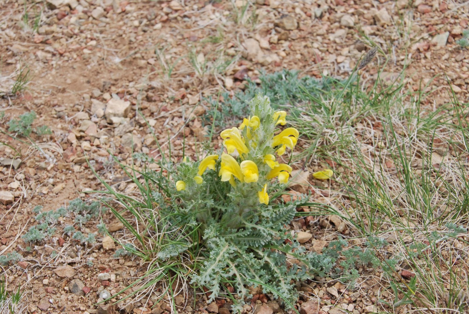
But for me the most striking and memorable thing is the vast meadows and hillsides of wild flowers. We were particularly lucky in that there had been plentiful rain in the spring before we arrived and even the Gobi desert grasses were green instead of their usual burnt brown.
The profusion of wild flowers of all colours and varieties was something I have never seen before—mauve, pink, lilac, purple, dark blue, light blue all shades of yellow, gold, orange, red, burgundy, pale green, cream, white. They were alone well worth the trip for me. The most beautiful for me was the orange Asian globe flower. Apparently you can get it as garden plant (it is a ranuncula) but seeing it in the wild is quite something. My photographs really don’t do the flowers justice so I highly recommend looking at those of Marian Herz who was on our trip and is a fantastic nature photographer.
http://marianherz.zenfolio.com/recent.html
If you don't care much for flowers just scroll through the next batch of photos quickly. I haven't captioned them because I don't know what most of them are! But they are lovely.


Very nice article! Many beautiful photos. But it has one little mistake. The highest located capital city in the world is not Ulan Bator. It's La Paz(3700 meters above sea level).
ReplyDelete